Pages

Wednesday, July 29, 2020

In My Footsteps: Talkin' 'bout My Generation


     I was born at an interesting time. I fall into a category of people who are old enough to remember things like rotary telephones and Atari, yet young enough to enjoy and appreciate smartphones. We are those in their late-30’s to early-40’s who straddle a line between generations. For most labeled generations, like Baby Boomers, Generation-X, Millennials (Generation-Y), etc there is a basic line of demarcation where one begins and one ends. However recently there has been an idea of something called a ‘micro generation.’ This is a smaller group of people, that I fall into, which is one-part Gen-X, one part Millennial. I have to tell you I think this is spot on accurate and here are some examples why just from my life.


     Growing up I always considered myself a prototypical Gen-Xer. I came of age listening to the Grunge music movement. I prided myself on my flannel shirts and torn jeans. My Senior yearbook photo featured a red flannel shirt. Hell, even to this day I have a Pandora music station called ‘Torn Jeans & Flannel’ celebrating my early-90’s music roots. The group Generation-X typically is referred to as those born between 1965-1980. The name itself was coined by war photographer Robert Capa. His phrase was first uttered in 1952 and referred to young people with a fatalistic view of the future. The term first came into pop culture though in 1991 with the release of Douglas Copeland’s novel of the same name.


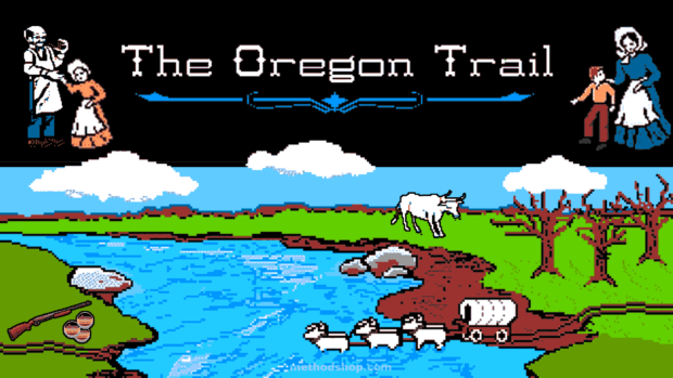
     Generation-X had the first personal computers in school, complete with dying on the Oregon Trail. They were kicked out of the house and told to stay outside and play until the street lights came on, yet when they got home they had a Nintendo game console waiting. They have been defined as lazy slackers as they got older yet have been at the forefront of entrepreneurial achievements. Defiant, independent, artistic, these characteristics all fit me and a majority of this generation to different degrees.

     A Millennial, also referred to as Generation-Y, is seen as the generation that directly followed Generation-X. Born roughly from 1981-2004 they are the generation currently stepping out on to the world’s stage in more important roles. They are seen as the group born into the time of technology. The current world of home computers, smartphones, GPS, self-parking cars, and the like are all just another part of the average Millennial’s life. They are a generation nearly double the size of Gen-X, rivaling the size of the Baby Boomer generation.


The original Super Mario Bros. on the NES (Paste Magazine.com)

     Millennials have been nurtured more than Gen-X, perhaps due to the changes seen in the world by the previous generation. The balance between staying outside to play and the lure of video games has shifted. Despite this fact Millennials are highly technologically savvy with their fingerprints all over smartphone apps and YouTube channels.

     Even though there are rough timelines of when Gen-X ended and Gen-Y began it is not reality to have a hard reset of the personality of a human. That being said there is bound to be some crossover of beliefs and traits of these two generations. Think of it as a Venn Diagram where the two circles bleed over into each other. This meeting of Gen-X and Gen-Y is the previously eluded to ‘micro generation,’ also called a ‘Xennial.’

     Seen as those born roughly between 1977-1983 a Xennial is a person who exudes traits of both generations. I first learned of this term from a USA Today article in December 2018. The idea of being somehow caught between the two generations is also referenced in a BuzzFeed.com piece from July 2013. It actually lists the characteristics of a Xennial. Only after reading this piece did I realize it described me to a T.

     For me personally I relate to absolutely loving the technological advances over the last few decades. Smartphones, streaming media, higher quality laptops, etc, however I am just as much at home grabbing my camera and finding a scenic area to take some pictures. That hearkens back to being a kid and being told to get outside during the summer and play and not to come back until it was dinner time. Granted the world is a different place today and many of the current younger generation probably wouldn’t be able to hours outside away from home so video games and other technology are a safer alternative.

80's Tech vs. Today (Wikimedia Commons, PxFuel)

     As a child of the 1980’s I feel a deep connection to that time period, yet actually came of age in the 1990’s. I like being seen as a Gen-Xer yet cannot deny the deep connection to the Gen-Y way of thinking. My biggest quirk when it comes to being a Xennial is the love of nostalgia while also being excited about what new technology is coming down the pipe. I have a soft spot for vinyl albums, Polaroid instant photos, VHS tapes, Super Mario Bros., Reading Rainbow, and 70’s/80’s television commercial jingles and mascots. Yet I also love being able to type a few words and instantly being able to research something that would have taken me hours and many trips to the library in high school. I love new smartphone apps that make life quicker and easier, I love being able to digitize old home movies on my laptop, and typing the address on a GPS and not having to think about where I’m going. I am a retro techno geek.

     So what about you? Are you a full-on Gen-Xer? Generation-Y(Millennial)? Or a Xennial like me? Check out the links below especially the Buzz Feed list, that might blow your mind like it did mine when I first read it.


     Links:

----------------------------------------------
My first eBook in 10 years, In Their Footsteps, featuring the interesting stories of Cape Cod's history, is on sale at Amazon.com

Sunday, July 26, 2020

In Their Footsteps: Cape Cod History - The Cape's Drive-Ins


     The drive-in movie theater was at one time a staple of American life. Being able to enjoy a film on a large outdoor screen from the luxury of the inside of your car was a cherished memory for so many over several decades. Even though in 2020 there are only approximately 321 remaining there are still some classic drive-in theaters left in the country. On Cape Cod for so long the Wellfleet Drive-In was the last remaining vestige of a bygone era. However that changed in the summer of 2020 when the former Yarmouth Drive-In was brought back to life more than three decades after initially closing.

     The story of the drive-in is long and storied and intertwined with the Cape. Though there were drive-ins of a sort as far back as the 1910’s the first true, patented drive-in theater debuted on June 6, 1933. The first proper drive-in theater was the brainchild of Richard Hollingshead. He took the existing idea of watching silent films outdoors on screens and added the ability for the wildly popular automobile to become a part of it. Hollingshead opened his creation in Camden, New Jersey with a showing of the British comedy Wives Beware. Tickets cost 25 cents per person and also 25 cents per vehicle. The Camden Drive-In had a capacity of 400 cars and 600 people attended that first night’s showing.

The screen at the Camden Drive-In (Cinema Treasures.org)


     His investment of $30,000 ($595,000 in 2020) spawned a new industry that would sweep the nation. Though primitive in the beginning, including not having the individual speakers for cars, the drive-in slowly began to catch on. In January 1938 plans were discussed for a potential drive-in near the Barnstable Airport in Hyannis. These discussions were brief as the potential of such an attraction was not seen as being an asset to the Cape.

     By the end of the 1930’s there were 18 drive-ins located in America. These included four in Massachusetts in Weymouth, Lynn, Shrewsbury, and Methuen. In 1948 that number had leaped to 820 total theaters. It was around this time that the drive-in was finally seen as a worthwhile investment for Cape Cod.

     In May 1949 building contractor Louis Segrini of Mansfield, Massachusetts was granted a permit to build the first drive-in on Cape Cod. This drive-in would be far more than a place to watch movies in your car though. The 70 acre plot located on Hokum Rock Road in Dennis, near Rt. 134, was at the time the largest drive-in in New England. It had a capacity of 1,000 cars and would also become the first fly-in theater. This distinction came from the fact that small airplanes and helicopters could land on a strip near the back end of the grounds and taxi their way to spots to watch the movies from inside the plane. In addition to being the largest theater and a fly-in theater the Dennis Drive-In included a dance pavilion, bottle warming service for young mothers, refreshment stands, and even 20 nearby cottages to rent.

The Dennis Drive-In, 1949 (Cinema Treasures.org)


     Opening night was Saturday July 16, 1949. The theater played the color film Barkleys of Broadway featuring Fred Astaire and Ginger Rogers. It was a near sellout close to 1,000 cars. Rather than rest on his laurels Segrini parlayed the success of the Dennis Drive-In to a second theater planned for near the Mashpee Rotary in 1950. These plans never materialized. Cape Cod had to wait six years for a second drive-in to open.

     It was in the 1950’s that the drive-in hit its apex as an entertainment attraction. This was the case on Cape Cod as well. Herman Rifkin opened the Cod Drive-In in the Teaticket section of Falmouth in 1955. This was followed quickly by the Hyannis Drive-In on Rt. 132. The Yarmouth Drive-In on Rt. 28 followed in 1956 and finally the Wellfleet Drive-In was built on Rt. 6 in 1957. This brought the total to five drive-ins on Cape Cod. In 1958 the total number of theaters in the United States hit its high of 4,063.
The drive-in had continued success throughout the 1960’s and into the 1970’s. However the tide slowly began to turn. An increase in land values, the advent of VCR’s, and the fact that drive-in shows had to begin late with summer sunset times started to eat into business. By 1980 there were just over 2,000 drive-ins left. The 1980’s saw the virtual end of the industry on Cape Cod.

     It began in 1980 when the Cod Drive-In closed. The land just off of Rt. 28 was owned for years by the Augusta Family who own the abutting Falmouth Lumber. In the spring of 2003 a 23.7-acre parcel of the former drive-in land was purchased by the Town of Falmouth. As of 2020 though nothing has been done with that property.

     Next to close was the Dennis Drive-In in 1984. The property was to be turned into a housing subdivision however as of 2020 much of the property remains overgrown. Upon walking over the former grounds one can find chunks of asphalt, concrete, former speaker stands, and wire littered about.

The Wellfleet Drive-In, for decades the last one standing until 2020. (Massachusetts Office of Travel and Tourism)


     The Yarmouth Drive-In initially closed in 1985. Throughout the years many ideas were bandied about as to what should become of the 22-acre site. A river walk consisting of trails and boardwalks leading along Parker’s River out to Seagull Beach had potential yet never materialized. In July 2020 it was resurrected by Innovation Arts & Entertainment. The new Yarmouth Drive-In has been updated for the 21st century with bright LED screens making daytime movies possible.

     In 1987 the Hyannis Drive-In became the fourth to close on the Cape in seven years. Though religious services took place on the grounds for a short time afterwards the property would eventually become home to Stop & Shop. It was also in 1987 where the total number of drive-ins dipped below 1,000 nationwide.

     The Wellfleet Drive-In for more than thirty years stood tall as the last beacon of a bygone era. It became a popular summer destination for those wishing for a slice of 1950’s nostalgia in a 21st century world. As of 2020 it remains a perfect family night out during the summer.

     The drive-in theatre for a time was the place to see new movies. It became as much a part of pop culture of a bygone generation as the movies themselves did. Though their numbers massively dwindled as the decades passed the drive-in is not finished yet. In a time where social distancing is the new normal there is a potential for a comeback of some of these beloved old school icons.

    So what became of Richard Hollingshead’s original Camden Drive-In? Partially due to high movie rental costs and lower than expected crowds Hollingshead sold his theater less than three years after opening it to a man who ‘moved’ the business to Union, New Jersey. It did not reopen. The final insult came when Hollingshead’s company was sued in 1950 and lost his patent on some of the designs of the drive-in, the large rush of new theaters came shortly thereafter.
---------------------------------------------


My first eBook in 10 years, In Their Footsteps, featuring the interesting stories of Cape Cod's history, is on sale at Amazon.com


Wednesday, July 22, 2020

In Their Footsteps: Cape Cod History - The Wellfleet Marconi Station


    On January 18, 1903 the first ever two-way wireless communication took place between President Theodore Roosevelt and England’s King Edward VII. It changed the landscape of communication forever and paved the way for radio and television to become a staple of life only a few decades later. The site for this historic milestone was not a big city. It was a remote section of beach in Wellfleet on Cape Cod. The man behind this newfound wonder was Guglielmo Marconi. This is the story of his wireless site that changed the world forever.

     Guglielmo Marconi was born in Bologna, Italy on April 25, 1874. He became a physicist and in 1894 first began experimenting with radio waves as a student at the Livorno Technical Institute in Rome. Basing his work on advancing the previous work of Henry Hertz and Oliver Lodge Marconi was able to develop a basic system of wireless telegraphy. From there he received his first patent in England in 1897.


The former pavilion at the Marconi Site from 2011


     After founding the England-based Marconi Telegraph Company in 1899 Marconi got started on perfecting his wireless telegraph. His first transmission traveled only a mile and a half but was a success. In March 1900 rumors circulated that perhaps a Marconi wireless station could be constructed on the Nantucket South Shoal Lightship.

     In order to assure a clear path between receivers Marconi looked for a companion site to his wireless station in Poldhu on England’s west coast. He found a perfect location in Wellfleet on Cape Cod. Plans for the construction of a wireless station at Wellfleet began in May 1901 with the money for the station being fronted by English capitalists and the work done by Boston contractors.

     The Wellfleet station was situated on eight acres of land, equipped with ten sets of two poles. Each pole stood nearly 100-feet tall and were set in a semi-circle fashion. The poles cost $2,900 ($88,000 in 2020) each to build. In June 1901 the long-rumored wireless station on the Nantucket Lightship was constructed, although this would only be connected to Sankaty Head Lighthouse approximately forty-eight miles away.

     Catastrophe came that November when the strongest storm in three years roared across Cape Cod. The Marconi station in Wellfleet was completely destroyed leaving vessels traveling between New York and Europe without the added aide.
Ironically it was only when the station was damaged by the storm that the people of Wellfleet discovered that it was owned by Guglielmo Marconi. It had been built in relative secrecy. Despite his great accomplishments in the field Marconi himself remained reserved, not wanting to seem boastful of how his invention was revolutionizing communication.


Guglielmo Marconi posing with his early wireless apparatus at the turn of the 20th century. (Smithsonian)


     In December 1901 a wireless station was built at Signal Hill in St. John’s, Newfoundland. This allowed Marconi to continue with his experiments with the technology while the Wellfleet station was being rebuilt. Signal Hill was about as close as North America could get to England being 900 miles closer to the Poldhu station than the Wellfleet location.

     It took more than a full year for the new wireless station to be finished in Wellfleet. In December 1902 it was completed with four 250-foot tall towers on a rectangular base replacing the original setup. Marconi himself arrived from Sydney, Australia to inspect the station marking the first time he had set foot on Cape Cod.
Not long after his arrival on the Cape Marconi and his assistant George S. Kemp got to work on what would be his greatest achievement to that point. The messages between the two world leaders was to be the grand reopening of the Marconi Wireless Station in Wellfleet. The Wellfleet station initially had the call letters CC (Cape Cod), this would change to MCC (Marconi Cape Cod), and finally to WCC when all eastern stations took the W prefix.

     As previously stated the date of January 19, 1903 was a landmark day in communication. It was on that date where the first two-way wireless conversation took place between President Theodore Roosevelt and King Edward VII.

     This accomplishment made it impossible for Guglielmo Marconi to remain in the shadows of success any longer. Within a week of the transatlantic conversation reporters from the leading newspapers and magazines of Boston and New York descended upon Wellfleet for a chance to find out about the man behind the invention. Marconi had high hopes of securing the rights to wireless communication basically everywhere in the world. He was referred to in some newspapers as a ‘wizard’ and his achievements were seen as more impressive by the fact that he was not even twenty-nine years old yet. Just as the fervor around the young inventor reached a fevered pitch Marconi left Cape Cod and returned to England by way of New York. He would return often to Cape Cod however.

     Marconi’s goal of commercializing wireless communication came true in September 1907. The messages were sent at a rate of twenty words per minute with the cost ranging from 10 cents a word for regular messages ($2.74 in 2020), and 5 cents a word for press related messages ($1.37 in 2020). In 1909 Marconi received the Nobel Prize for Physics sharing the prize with fellow wireless communication pioneer German physicist Karl Ferdinand Braun.

     A second wireless station was built by Marconi in Chatham overlooking Ryder’s Cove in 1914. The site was chosen for its relative isolation and was built for a total cost of $300,000 ($7.7 million in 2020). In 1920 the station became part of the Radio Corporation of America (RCA). It inherited the WCC call letters and became the busiest ship-to-shore station during much of the 20th century.


A postcard of the Wellfleet Marconi Site from 1905.


     When World War I came knocking for America the United States Navy took possession of the Wellfleet station as well as the Chatham site. In April 1917 the Wellfleet site fell under the command of J.W. Mullins, the chief electrician of the Navy. This proved to be the beginning of the end for the wireless station on the Outer Cape. After the war ended the station closed. The writing was on the wall from nature as well.

     The bluffs along the Outer Cape have been ravaged by erosion for many decades. Even a century ago the cliffs rapidly eroding to the point that the concrete bases closest to them were already being compromised before the station’s official closing. Despite rumors of the station possibly reopening late in 1919 nothing came to fruition. The closure of the Wellfleet Marconi station was a mixed blessing for the residents of the town. They were not completely upset with its demise due to the fact that while in operation the sparking of 30,000 watts supplied by the three-foot rotor could be heard up to four miles away.

     Guglielmo Marconi continued his research and experiments with wireless technology throughout the remainder of his life. Some later achievements included a mean system for long distance communication and experimentation with microwaves and the principles for developing radar. He received numerous honorary degrees and awards during his lifetime. After a few years of declining health Marconi died in Rome, Italy from a series of heart attacks on July 20, 1937 at the age of 63.

     His Wellfleet wireless station site would be wiped off the map entirely over time. It was dismantled in 1920. Between 1902 and 1972 the bluff in front of the station eroded 170 feet. Two of the concrete bases for the towers eventually fell to the sea. Camp Wellfleet was constructed on the grounds in 1942 and remained there until 1961 when after it was deemed unnecessary it became a part of the new Cape Cod National Seashore.

     In 1953 a plaque commemorating the conversation between Roosevelt and King Edward from 1903 was placed at the site. A shelter was constructed in 1974 housing a scale replica of the wireless site along with a bronze bust of Guglielmo Marconi. The beach below the cliffs was named Marconi Beach for the inventor.


An exposed base from the Marconi Wireless Site in 2011


     In a final piece of irony the eroding cliffs claimed the replica of the station as well. In July 2013 the replica and bust were removed and the shelter demolished. Incredibly only a short time before this a pair of the original concrete bases were exposed at the beach below. Sadly today the only remains of the original Marconi wireless station are bits of wood and brick gathered neatly in an area close to the eroding cliffs. Someday those will have to be removed as well.
----------------------------------------

My first eBook in 10 years, In Their Footsteps, featuring the interesting stories of Cape Cod's history, is on sale at Amazon.com


Wednesday, July 15, 2020

In Their Footsteps: Cape Cod History - Samuel de Champlain and Port Fortune


     “What’s in a name?”

     It is part of a famous quote from legendary scribe William Shakespeare’s Romeo and Juliet. Every person, place, and thing has a name that becomes synonymous with them. In most cases when something is named that name remains unchanged through time. Cape Cod gained its name in 1602 through English explorer Bartholomew Gosnold. It has remained unchanged for more than four centuries.

    Village names on the Cape came as communities were established, mostly based upon English towns. Sandwich, Yarmouth, Falmouth, and others were named for places across the Atlantic.

     It is a rarity that a town changes its name once it has been decided upon. There have been some examples like when Hot Springs, New Mexico became Truth Or Consequences after the game show, or when Clark, Texas became DISH after the satellite television company. One change of interest locally came in 1997 when the town of Gay Head on Martha’s Vineyard was changed to Aquinnah. Another name change was bandied about on Cape Cod that not many may be aware of. It was a name given to a Cape Cod town by another famed explorer. This is the story of that explorer and his journey to the Cape.

     Only a few years after Gosnold explored and gave Cape Cod its name another world famous explorer found his way to the peninsula. French explorer Samuel de Champlain made at least 21 voyages across the Atlantic Ocean to North America beginning in 1599. His first voyage was to check on the colonies in the West Indies (Caribbean) for the Spanish government. His second trip in 1603 led Champlain to present-day Nova Scotia and the St. Lawrence River in Canada. It was his third New World trip in 1604 which led him to Cape Cod for the first time.

    After beginning the exploration of North America once again in Nova Scotia the expedition of three ships, including Champlain’s ship Don de Dieu, began venturing south. In the spring of 1605, after enduring a harsh Canadian winter, Champlain and the rest of the expedition headed south, mapping the coastlines of Maine, New Hampshire, and into Massachusetts. The venture was to find a suitable location for a French settlement.

     The initial contact with Cape Cod for Champlain occurred as he landed in present-day Eastham. He likely sailed into Pleasant Bay and could have landed between the location of the Salt Pond Visitors Center and Fort Hill. The stay was very brief and Champlain’s crew returned north. Ultimately a settlement was established near the mouth of the Annapolis River in Nova Scotia at the end of the summer of 1605. It was named Port Royal and became the home base for further exploration of the North American coastline.

    A voyage south to Florida in the spring of 1606 failed due to weather and lack of supplies among other things. The next trip returned Champlain to Cape Cod in the fall of 1606. It was this time that he became the first European to visit what is today known as Chatham.

Champlain's Map of Stage Harbor with Harding's Beach Point along the bottom.


     In October 1606 Champlain first returned to Eastham and was greeted in a friendly manner from the Natives. After a short visit they continued south and were nearly wrecked on the shoals surrounding Monomoy Island. Eventually they entered present-day Stage Harbor and docked. Champlain would sketch out the area and even dubbed it initially ‘Port Fortune.’

     The crew stayed on shore with the Natives for more than a week. It was initially a pleasant stay but eventually turned hostile as the Natives felt the French had overstayed their welcome. An early morning attack by the Natives on their last day at Port Fortune left four of Champlain’s crew dead and the rest of them lucky to escape the bloody skirmish. Later on Port Fortune would be referred to as ‘Misfortune’ due to this event.

Present-day view of Stage Harbor with Harding's Beach Point along the bottom. (Google Maps)


     The expedition continued on southwesterly until they gained sight of Martha’s Vineyard on October 20, 1606, although Champlain was not certain if this was part of mainland Cape Cod. A strong storm forced the ship to turn back and reluctantly dock in Stage Harbor again. It was here while awaiting favorable winds that Champlain’s crew enacted revenge on the Natives killing several of them while under the guise of friendship. 

     Once the weather was up to par the expedition left Stage Harbor and, except for a brief return to Eastham on the way back to Port Royal, would never see Cape Cod again. Champlain became the first European to visit Chatham and no other would step foot there for fifty years until William Nickerson arrived in 1656.

    Samuel de Champlain died on Christmas Day in 1635 in Quebec City. He had returned there in 1633 and acted as governor until his death. His legacy was as the ‘Father of New France’ for his cartography of much of the eastern coast from Nova Scotia to Cape Cod and his establishment of Quebec in Canada. However Champlain’s connection to Cape Cod came back to the forefront three centuries after his death.

     In 1937 the Port Fortune Society was formed with the intention of changing the name of Chatham to the name originally given to the land by Champlain upon his arrival. The idea for the change came from the minds of two people. There was Chatham artist Harold Dunbar who thought the name change would be a way to honor Champlain as the ‘grandfather of our country.’ The second was retired Professor Carol Wight of Johns Hopkins University who did not see the appeal in honoring William Pitt the English Earl of Chatham who never stepped foot on the land.

     Their cause was championed by Ben Adams Buck who was president of the Port Fortune Society, a lifelong Chatham resident and Cape Cod historian. In April 1937 the group’s intentions were declared in a long newspaper article. Though initially making waves with its declaration nothing came of the name change attempt and the Port Fortune Society became a mere footnote in Cape Cod history.
The Champlain stone marker near Stage Harbor.


     In the end the Port Fortune name did end up being a part of Chatham. There was the seasonal restaurant and lodge on the corner of Main Street and Hallett Street called The Port Fortune. It started as a restaurant in the 1930’s and later became a bed and breakfast called the Port Fortune Inn. This existed until just after the turn of the 21st century when it became a private home.
Samuel de Champlain’s connection to the Cape today still remains.

     Though unsuccessful at changing the name of Chatham to Port Fortune Carol Wight succeeded in having a stone marker commemorating Champlain’s Cape Cod visits created near Stage Harbor in the 1930’s. Champlain’s detailed map of Stage Harbor can still be viewed and some fixtures of Chatham’s landscape like Mill Pond and Oyster Pond can be made out in the sketches.
---------------------------------------

My first eBook in 10 years, In Their Footsteps, featuring the interesting stories of Cape Cod's history, is on sale at Amazon.com


Wednesday, July 8, 2020

In Their Footsteps: Cape Cod History - The Great Colonial Hurricane, Anthony Thacher, and Yarmouth


     There are some events that shape and change people and history. Natural disasters, especially those of tremendous magnitude have a tendency to change the area they strike after the fact. Earthquakes, tsunamis, tornadoes, and more ravage the Earth leaving death and destruction in their wake. Along coastal areas the hurricane/typhoon is often the natural disaster that causes the most damage.

     There have been many deadly hurricanes whose names bring back horrible memories to those who lived through them. Katrina in 2005, Maria in 2017, the Galveston, Texas Hurricane in 1900, and Florida’s Okeechobee Hurricane in 1928, are among the costliest storms to ever hit America. In the New England area the list of famed storms is far less deadly due to the cooler ocean waters. The most recognizable names like Bob in 1991, Gloria in 1985, and Carol in 1954 did their share of damage yet were not as deadly as the southern storms.
   
      However, centuries ago, during the infancy of European colonization of America, a major hurricane struck New England. This storm changed the landscape. It changed the lives of countless colonists and Native Americans. It decimated a family and gave rise to one of Cape Cod’s original settlements. The storm was the Great Colonial Hurricane of 1635. This is the story of the storm and how its effects are still felt today.

     Though the storm itself occurred in 1635 the story begins in 1589. It was in this year, in the village of Queen Camel in Somersetshire County, England that Anthony Thacher was born. After receiving a good education Thacher became curate at St. Edmunds Church in Salisbury, where his brother Peter was the minister, in 1624. By that point the first of the Pilgrims had left England for America due to the perceived religious persecution. This had not changed in the years after and eventually would cause Thacher to travel the same route as the others.

     In July 1634 Thacher’s wife Mary died after roughly 15 years of marriage. He was remarried to Elizabeth Jones in February 1635. Shortly thereafter on April 6, 1635 he boarded the 220-ton ship James with Elizabeth, her father, and four of his five children, along with his brother Peter’s son Thomas. Anthony Thacher was listed in the registry as a tailor, likely to disguise his true relationship with the church. The vessel departed England and arrived in Boston in June.

     Thacher started his time in America in Newbury working alongside his cousin John Avery. However after much pleading from its citizens Avery decided to move south to Marblehead to establish a church there. Thacher and his family decided to join him in starting the church.

     In late August 1635 the entire entourage, except for Anthony’s nephew Thomas, boarded a vessel called the Watch and Wait. Thomas, who had a bad premonition about the ship, decided to travel to Marblehead by land. In total 23 people left Ipswich on the ship which would soon collide with an historic storm.

     What would become known later as the ‘Great Colonial Hurricane’ first formed during the last week of August narrowly avoiding the Jamestown Settlement in Virginia. As the storm headed northeast it quickly gained strength until eventually topping out at what today would be a high Category 3 to low Category 4 hurricane. It is estimated by National Oceanic and Atmospheric Administration (NOAA) that the storm took a path similar to Bob in August 1991.

     On August 26, 1635 the storm crossed near Providence, Rhode Island just after 6am with wind speeds hovering around 130mph. The storm surge was estimated at 14 feet there with many Natives being swept out to sea with their homes. It plowed through Boston near 7:30 as it began to lose some strength. Governor of Plymouth William Bradford noted seas as high as 20-feet above normal as the hurricane barreled through the area. It was as the storm exited to the Atlantic just north of Boston that it met up with the Watch and Wait and Anthony Thacher. With winds still topping 105mph the storm crashed into the vessel east of Gloucester driving it onto a small, rocky island. 

The likely path of the Great Colonial Hurricane. (Harvard Forest Archives/Brian R. Hall)


     The wind and waves dashed the vessel to pieces. Before his very eyes Anthony Thacher watched as his cousin John Avery and his six children drowned. For a time Thacher’s family clung to the rocks, however the crashing waves eventually pulled all of his children out to sea as well. Anthony and his wife Elizabeth managed to hold on. They were the only survivors.

     All told according to NOAA the Great Colonial Hurricane was likely the most intense storm north of the Carolinas in recorded history. The storm surge above 14-feet in Providence was topped by a surge above 20-feet at the head of Buzzards Bay. Thousands of trees were downed in its path, and many buildings were destroyed and people washed away in Providence, Plymouth, Boston, Bourne and more. It was said that the damage from the hurricane was still evident decades later.

Thacher Island in Rockport.


     Anthony and Elizabeth survived for two days on the rocky island before being rescued by a passing vessel. The island was given to them as consolation with Anthony initially naming it ‘Thacher’s Woe.’ Years late it was named Thacher Island in commemoration of the couple’s immense loss. The death of the children diminished their desire to remain on the North Shore and when an opportunity arose to leave they took it.

     On January 7, 1639 the Plymouth Court granted a large tract of land on Cape Cod to Anthony Thacher, Thomas Howes, and John Crow. Formerly referred to as ‘Mattacheeset’ it was henceforth known as Yarmouth. Technically the lands given included the future town of Dennis as well. Thacher settled in the area later that year near the marshland of present-day Yarmouth Port just north of Rt. 6A.

     Not long after arriving Thacher became Town Clerk and Town Treasurer of Yarmouth, both positions he held until his death. After the horrific loss of four children during the Great Colonial Hurricane Thacher had three children with Elizabeth. In 1664 Anthony had a home built for his son John upon his marriage. This home sat at the corner of present-day Thacher Street and Thacher Shore Road. It was moved in 1680 to its current location at the corner of Route 6A and Thacher Street across from the Yarmouth Port Post Office.

The home Anthony Thacher had built for his son John now at 240 Rt. 6A Yarmouth Port.


     Anthony Thacher remained of major importance in Yarmouth and its affairs throughout his life. His exact date of death is not known, though it is between June 30-August 22, 1667. Thacher died at the likely age of 78. He was buried on his land near the marsh in Yarmouth Port. His grave was never marked with a stone. His wife Elizabeth died only a few months later.

     In 1905 a stone tablet was erected near the site of Anthony Thacher’s homestead. Three years later in 1908 the Thacher family gave the Town of Yarmouth Thacher Shore Road which was purported to have been the old Colonial road built along and over some of Anthony’s property. Thacher Island in Rockport became a popular tourist destination with its twin lighthouses. The current lighthouses were built in 1861 and it is accessible by boat or kayak from the shore.

     Through immense suffering and sadness Anthony Thacher persevered and helped to found the town of Yarmouth. He came face to face with the strongest hurricane these parts has ever seen and did not allow it to define him. The Great Colonial Hurricane of 1635 did tremendous damage yet also shaped and changed New England in its aftermath. It led to the formation of a Cape Cod town and serves as a tale of destruction and redemption not only for the New England area affected but for Anthony Thacher himself as well.

For more about the story of the Great Colonial Hurricane check 


-------------------------------------------------------------
My first eBook in 10 years, In Their Footsteps, featuring the interesting stories of Cape Cod's history, is on sale at Amazon.com

Thursday, July 2, 2020

In Their Footsteps: Cape Cod History - The Cape's Conservation Story


     The world’s population as of 2020 is 7.8 billion people. The total land area of the planet is 148.94 million square miles as of 2017, and that includes areas not suitable for human habitation. As the population continues to grow developable land is becoming more and more of a premium.

     It is true everywhere including Cape Cod. The population of the peninsula as of 2018 was 213,471. This is up a whopping 300% from the population of 70,286 in 1960. According to a United States Geological Survey in 2018 Cape Cod has lost approximately 4,400 acres of land due to erosion over the preceding 100 years. This means as the population grows usable lands shrinks.

     A major development in the 20th century was that of land conservation to protect and maintain the beauty of nature for generations to come. The conservation of land in American began in 1901 when Theodore Roosevelt was elected President. Roosevelt established 150 national forests, 51 federal bird reserves, 4 national game preserves, 5 national parks and 18 national monuments on more than 230 million acres of public land.

Theodore Roosevelt at Yosemite National Park c.1903 (National Park Service)


     Cape Cod has its own share of beloved conservation areas such as the Cape Cod National Seashore and Nickerson State Park. These are two of the biggest parcels of conserved land on Cape Cod and only two of many. However it all began somewhere. The movement toward preserving the natural beauty of Cape Cod ensuring that it would not be developed as the population grew. This is the story of the beginnings of the conservation movement on the Cape.

     Though President Roosevelt brought the conservation of land to the forefront in 1901 in Massachusetts protecting the natural resources began a bit earlier. In April 1891 the state established The Trustees of Public Reservations for the purpose of ‘acquiring, holding, arranging, maintaining and opening to the public...beautiful and historical places and tracts of land in the state.’ In 1954 it dropped the ‘Public’ from its name and as of 2020 it owns, assists with, or holds under conservation restrictions more than 72,000 acres of land in Massachusetts.

     In June 1909 a Bill was signed by Governor Eben Draper for improvements to aide the conservation of Bass River entrance. The $10,000 ($281,000 in 2020) Bill allowed for the restoration of stone jetties to help prevent shoaling and slow erosion. Also in 1909 the first public wellfield was created in Truro in the interest of protecting aquifer lands; this wellfield served Provincetown.

     In March 1913 the Dennis Village Improvement Society created the first public park on Cape Cod. This was located on what was called the North Mill Lot, at the meeting of New Boston Rd. and Nobscussett Rd. This was where the first windmill in town was built in 1745. Today the Dennis Village Playground still stands at the site. In 1920 the first steps were made to protect the wondrous Sandy Neck. Two acres of land was donated to the Town of Barnstable by John D.W. Bodfish in the memory of his father Benjamin in 1920. It was given to assure that the public could have access to the beach. After many more donations of land over the last century Sandy Neck Beach Park stands at 4,700 acres of natural beauty preserved with 1,500 acres open for all to enjoy. Nickerson State Park was born in September 1934 when Roland C. Nickerson’s widow Addie donated 1,900 acres of land to the Commonwealth of Massachusetts.

A marker for North Mill Lot with the Dennis Playground behind it.


     Various donations were made over the years helping to increase the amount of protected Cape Cod land. Eventually though it became necessary to create organizations dedicated to the acquisition and conservation of lands on the Cape. The first such organization came early in 1958 with the creation of a Conservation Commission in Barnstable.


     The largest addition to conservation land on Cape Cod came in August 1961. It was then that more than 43,000 acres of land on the Outer Cape was designated by President John F. Kennedy as the Cape Cod National Seashore. Inside the Seashore boundaries include such Cape Cod icons as Nauset Lighthouse, Coast Guard Beach, the Marconi Wireless Site, the Peaked Hill Bars Dune Shacks, and many more. In 2014 alone more than 4.4 million people paid visits to this crown jewel of Cape Cod conservation.


The high cliffs of Wellfleet in the Cape Cod National Seashore.


     A year after the creation of the National Seashore came another landmark in the Cape’s conservation efforts. Town conservation commissions had been popping up throughout Cape Cod in the years prior, however in 1962 the first private nonprofit land trust organization was formed. In August 1962 the Chatham Conservation Foundation was formed with the help of Robert McNeece, a town Selectman, former President of the Chatham Chamber of Commerce, and would become the head of the Cape Cod Baseball League from 1972-1976.

     The first land gift given to the Chatham Conservation Foundation came from Dorothea W. Smith on October 23, 1962. Her donation was Fox Hill Island, a 2.5 acre property located in Pleasant Bay just off of Eastward Point. Since that generous first donation the foundation had received many more to the tune of 224 parcels of land totaling more than 800 acres today.

     The concept of the nonprofit land trust was a success and as of 2016 there were 1,800 such entities in America with about 140 in Massachusetts alone. In 1986 the Compact of Cape Cod Conservation Trusts, Inc. was formed and currently works with 27 local and regional trusts for the continued protection and management of open space properties.

     For more than a century Cape Cod has been protecting and preserving much of its natural beauty for generations gone by and generations to come. There are giants like the Cape Cod National Seashore and Nickerson State Park. There are popular spots like Crowe’s Pasture in Dennis and South Cape Beach State Park in Mashpee. There are also lesser known gems like Monks Park in Pocasset and Bell’s Neck in Harwich. There is no shortage of beauty and wonder located outdoors on Cape Cod. Take a drive, take a ride, take a walk, just get out and enjoy it.
-------------------------------------------------------


My 5th book, Cape Cod Nights, is on sale at Amazon.com and through Arcadia Publishing