Pages

Showing posts with label orleans. Show all posts

Thursday, February 6, 2020

In Their Footsteps: Cape Cod History - The Wreck of the Montclair


     Cape Cod has seen countless shipwrecks over the centuries. Its shifting shoals and sand bars have always been hazardous to passing vessels especially on the Atlantic Ocean facing coastline. Between Race Point Beach in Provincetown and the southern tip of Monomoy Island in Chatham is nearly fifty miles of some of the most dangerous waters in the world. Estimates by the National Parks Service say there are upwards of 1,000 lost vessels in what is common referred to as an ‘ocean graveyard.’ Legendary wrecks include the 17th century Sparrowhawk, the 18th century Whydah pirate ship, the 19th century Portland, and 20th century Pendleton. Even vessels as large at the 473-foot Eldia, which was grounded on Nauset Beach in 1984, have not been able to escape the pull of the Cape’s sand bars.
     
     Some of these vessels, like the Sparrowhawk, have been revealed due to the shifting sands and had their wooden carcasses removed and put on display in local museums. One wreck that has been appearing and disappearing over the last decade is that of the Montclair. Located on southern Nauset Beach it is a glimpse into history and an adventure to explore. However it is a real ship and a real tragedy with numerous lives lost which happened nearly a century ago. This is the story behind the remains that have been photographed and shared throughout social media over the last several years. This is the story of the wreck of the Montclair.

The Orleans Lifesaving Station circa 1900, courtesy of Sam's Scrapbook.com

     The vessel known as the Montclair was a three-masted schooner. The 371-ton wooden ship was built in Yarmouth, Nova Scotia, Canada in 1918 and designated a transport vessel. It was owned by Captain C.B. Martin of Partridge Island, Nova Scotia.

     On Tuesday March 1, 1927 the 142-foot Montclair set sail from Halifax, Nova Scotia en route to New York City with a cargo of 2.5 million wood laths. It was headed by Captain William McLeod with a total crew of seven men. That same day a British vessel, the Frederick H., also left Nova Scotia with New York as its destination. Neither would reach its destination. The very next day the vessels began to feel the effects of a strong late-winter storm raging in from the southwest. Winds of up to 60 mph tore at the ships as they rounded Provincetown and headed down through the shoals of the Atlantic side of Cape Cod on March 3rd. McLeod had the utmost confidence in his vessel and pressed on south.

     The wind and waves pounded the Montclair and began pushing it in toward the shore as it headed past Nauset Beach. The ship lost two of its three masts, the fore and mizzen masts. Unable to control the vessel they could only hang on as it was pushed into the sandbars roughly a mile off shore just south of Nauset Beach. It was at this point, early on March 4th, that the peril of the Montclair awakened Captain Edward L. Clark. Clark was part of a skeleton crew of three men at Coast Guard Station #40 located just east of Little Pochet Island, two and a half miles south of the current Nauset Beach parking lot. The station had been designated inactive in the early 1920’s ironically due to the fact that there had not been any shipwrecks in the area for decades.

The wreck of the Montclair in 1927, courtesy of the William Quinn Collection

     Clark notified the Provincetown and Old Harbor (Chatham North Beach) Coast Guard stations and people rushed to the scene. After one last attempt to swing the Montclair clear of the shoals it was tossed up on to the sand where it was beaten by the waves of the high rising tide. The brave Coast Guard crews headed out into the wind and waves for an attempted rescue even managing to shoot three weighted lines over the stern of the crippled ship. Five members of the ship’s crew grabbed on to one line while the other two men grabbed another before the Montclair was broken in half near the middle. The five crew members including Captain McLeod were washed overboard while the other two men were picked up and brought back to shore.

     The splintered ship was eventually lifted off the sandbar by the tides and brought to shore where it was tossed up onto the sands of Nauset Beach. Its cargo of wood laths scattered for miles along the sand. The two survivors of the wreck Nathan Bagg and Gartland Short were treated for hypothermia and hysteria at the Coast Guard station. The body of Captain McLeod was quickly recovered while three of the other four missing were also quickly pulled from the water as the storm subsided and the sea calmed. The fifth and final deceased member of the Montclair’s crew would be discovered on March 15th on North Beach in Chatham by Wesley Eldredge mostly buried under the sand.

The remains of the Montclair today

     Much like with the grounding of the Eldia decades later countless residents came out to see the wreck of the Montclair with some helping themselves to some of the unbroken wood laths that had been deposited for a half-mile along the coast. Considered to be the worst maritime disaster on the Cape in more than twenty-five years questions were raised after as to whether more lives could have been saved if the Orleans Coast Guard station had been active.

     The Frederick H., which had left Nova Scotia the same day as the Montclair, also ran into the destructive storm as it sailed around Cape Cod. Badly damaged as well it managed to limp its way into Vineyard Haven only thanks to constant pumping of the water from the hold and galley of the vessel by the crew.

     Along the coast of Cape Cod at the same time author Henry Beston was residing at his ‘Fo’castle’ beach shack, writing his soon-to-be classic ‘The Outermost House.’ The news of the wreck of the Montclair made its way to Beston who immortalized the disaster in his book’s sixth chapter. Deputy Collector Thomas Finnegan reported to the scene from New Bedford with a team of eight men as the Montclair had been a suspected rum-running vessel. He questioned the two survivors but did not secure any useful information. One blessing from the disaster of the wreck was that the Orleans Coast Guard station was restored to full strength after it happened.

The remains of the Montclair today

     The shifting sands have buried and uncovered the remains of the Montclair several times over the decades. In the 2010’s it was revealed repeatedly, each time slightly more decayed than before. The wood is soft and rotting away, while the iron is rusty and gives the ship a ghostly skeletal appearance currently. It is nearly a two and a half miles walk over the sand to reach the remains of the Montclair.

     Though an interesting adventure taking the walk out to find its remains it is a somber and solemn reminder of the dangers of the sea. It is important to remember the five men who lost their lives aboard the Montclair as well: William Downing, William Stewart, George Cains, Jerome Butler, and Captain William McLeod.


My 5th book, Cape Cod Nights, is on sale at Amazon.com and through Arcadia Publishing


Cape Cod Sunsets 2020 Calendar available at Zazzle here: Cape Cod Living Store

Be sure to check out my website: Christopher Setterlund.com

Thursday, January 2, 2020

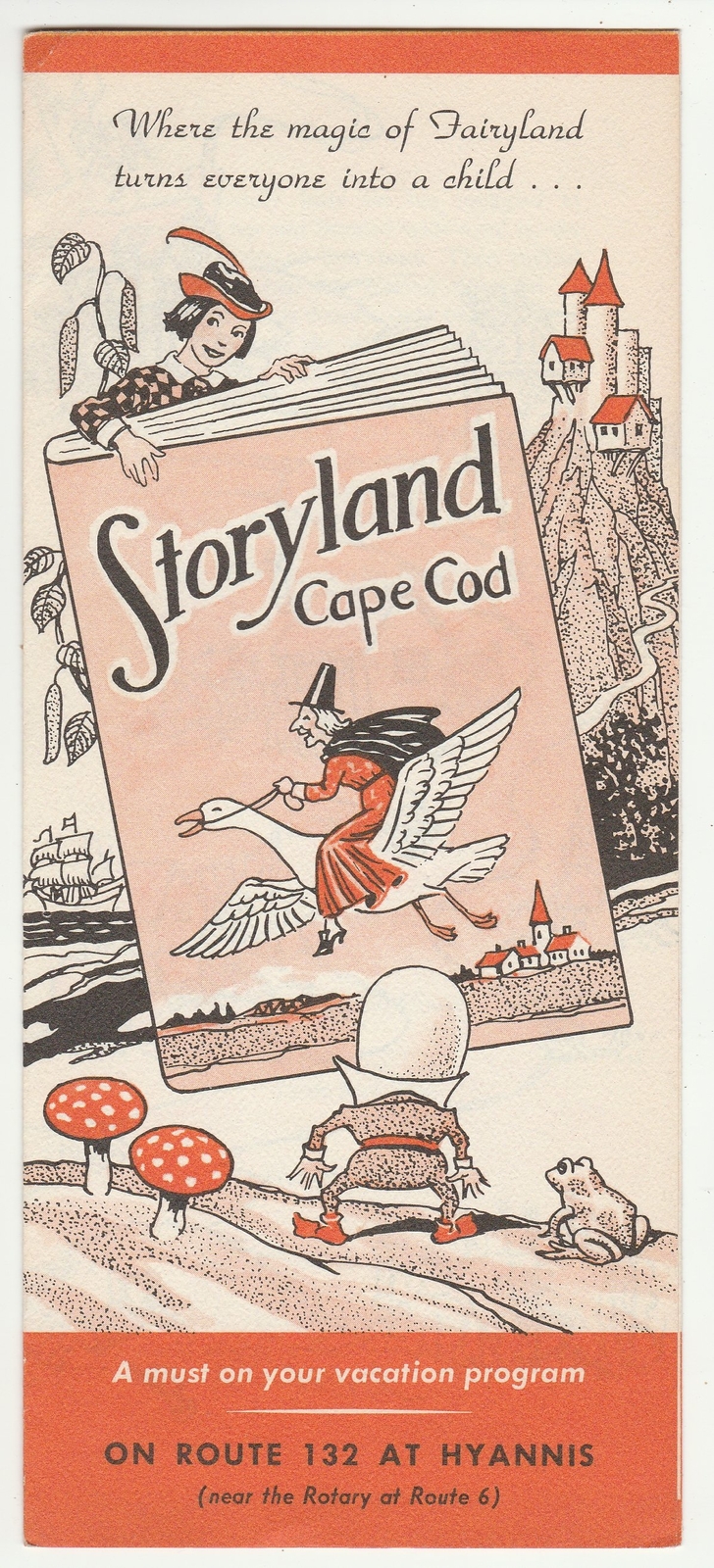
In Their Footsteps: Cape Cod History - Storyland Amusement Park, Hyannis


     Today on Cape Cod Hyannis is the hub of business. Route 132, Route 28, Main Street, these roads in Hyannis are lined virtually end to end with shops, restaurants, and other attractions. However there was a time before the endless array of businesses, it was a time before the Cape Cod Mall. In the middle of the 20th century Route 132 was a rural road, in place of stores there were thousands of trees. In the time between Hyannis being a rural village and it being the center of activity on Cape Cod there was an attraction that enthralled children and although it was short-lived it seemed to be a catalyst for the modernization of Cape Cod’s center. It was Storyland and this is its story and its impact.
     The idea for a children’s amusement park in the center of Cape Cod came from the mind of George G. Spalt, a Cape summer resident. Formerly from Loudonville, New York and working as a contractor in Albany Spalt saw several small children’s amusement parks during vacations to the Adirondack Mountains during the early 1950’s specifically Storytown USA which opened in 1954. George Spalt was inspired to create his own amusement park and found a perfect location along Route 132 in Hyannis only a half-mile from the airport.
Courtesy of The Imaginary World.com

     Plans were put in motion in March 1955 when Spalt, only thirty-four at the time, purchased a nine-acre lot on a heavily wooded section of Route 132. The park was based around the Mother Goose nursery rhymes. There were thirty structures scattered around the property along trails leading from the parking lot which had room for up to 400 vehicles. All in all the design of Storyland took three months and cost Spalt $40,000 to build ($384,000 in 2020). The park opened in June 1955 situated between a Sunoco gas station and the Top O’ the Morn Motel.
Courtesy of Imaginary World.com

     From the get go Storyland was a huge hit for its target audience. The trail leading to the park was like an entrance to a fairy tale world with attendants dressed as clowns. Nursery rhyme characters like the Big Bad Wolf, the Three Bears, Old Woman Who Lived In a Shoe, House That Jack Built, and many more were there to be seen. Many of them had large colorful buildings and figures. These were the work of Matthew Cobb, a talented artist whose great-great grandfather Daniel Cobb had run a general store in Barnstable at the turn of the 19th century. There were actors playing characters like Little Red Riding Hood, other figures were mechanical like the Big Bad Wolf who was voiced by an unseen actor including Cotuit Kettleer baseball player Frank Burleson in 1955. There were booths for candy and gifts and to top it all off there was a barnyard with farm animals, ponies, and even a duck pond.
     Spalt’s take on the children’s amusement park was a success. Children came for birthdays, on field trips, or just on a whim with their families. During its first few years not much changed in the surrounding area. Route 132 remained wooded and rural, so much so that when the locusts returned in 1957 you could hear their hum as you drove along the road. Hyannis though was always destined to become the hub of Cape Cod it seems.
Courtesy of The Imaginary World.com

     In 1961 plans began for the All-Cape Shopping Center located on forty-acres of land between Route 132 and Route 28 to the west of the Airport Rotary. Centered around Picture Pond the property would be Cape Cod’s largest shopping center, the land east of Storyland was bulldozed. The first business to be erected on the property was Abercrombie & Fitch going up in April 1963. Although the plaza never fully materialized it set plans in motion for the development of the area in the future. Miniature golf courses, restaurants, and hotels began to spring up in the area around Storyland during the early 1960’s. Despite its relative success the land Spalt’s property sat on was highly coveted.
     Based on Storyland’s success Spalt developed Adventureland in Newburyport, MA as well as Cowboy Town in Plainville, MA as he expanded his amusement park collection. A big change in Hyannis was in the works though. Over a period of two years negotiations were going on for the Storyland property and surrounding area with the desire to create Cape Cod’s largest shopping center and actually have it open this time. In July 1968 the negotiations were completed and signed off on at the Neptune Room restaurant. Anchored by Sears, Filene’s, and Woolworth the Cape Cod Mall was announced with an estimated price tag of $6 million ($44 million in 2020).
     Storyland was on borrowed time during the 1968 season and George Spalt looked for alternative locations for his beloved amusement park. As luck would have it Spalt found a new home for his amusement park in Orleans. In January 1969 the process began of moving all of the structures from the Hyannis property to a filled in cranberry bog near the Orleans Rotary. It was moved and ready to reopen in time for the summer.
     As for the Cape Cod Mall the skeleton structure began to rise from the ground during the summer of 1969 with the first section of the complex opening to the public on Tuesday August 4, 1970. Twenty-eight stores would open that day bringing a culmination of the four and a half years from planning to completion. Today the mall is a Cape Cod staple, checking in at over 800,000 square feet and currently undergoing yet another expansion with Target opening this past fall and Dick’s Sporting Goods in the spring of 2020.
     Storyland’s second chapter in Orleans was not quite as successful as its tenure in Hyannis. By 1974 the park was closed and sat abandoned for several years. The property eventually became home to Stop & Shop. For those of a certain age that grew up on Cape Cod the short-lived little amusement park known as Storyland will live forever in their memories.

View my previous blog posts: In My Footsteps: My Cape Cod Roots


Cape Cod Sunsets 2020 Calendar available at Zazzle here: Cape Cod Living Store

Be sure to check out my website: Christopher Setterlund.com

My 5th book, Cape Cod Nights, is on sale at Amazon.com and through Arcadia Publishing

Monday, May 12, 2014

In My Footsteps: Cape Cod - Rock Harbor


My first book, In My Footsteps: A Cape Cod Travel Guide, is available at SchifferBooks.com, BarnesandNoble.com, and Amazon.com, and stores everywhere!  Follow me on Twitter and YouTube for more on In My Footsteps.


Come and see me at Sandwich Heritage Day June 14th

East Bridgewater Library June 16th

and Books By the Sea, Osterville July 5th


Wednesday, January 22, 2014

Thursday, January 28, 2010

In My Footsteps: Trip 12: Orleans, Mass.


In My Footsteps
Christopher Setterlund
Trip 12: Orleans, Mass.
January 26, 2010

From the air Cape Cod is shaped like an arm with the Cape Cod Canal at the shoulder and Provincetown as the hand.  If we see Cape Cod in that way then Orleans would be considered the elbow, and in many ways it is.  The elbow connects the upper and lower arm, Orleans connects the two segments of Cape Cod as well.  West of Orleans is the more modern segment of the Cape including larger towns like Hyannis and Falmouth.  East and North of Orleans house the quainter and more secluded spots on the Cape like the National Seashore.  Orleans represents the last real taste of 21st Century Cape Cod on the way to the Outer Cape. 

A trip to Orleans, especially in summer, inevitably leads you to the famous Nauset Beach(right).  Nauset Beach, named for the Native American tribe that originally inhabited the area, is one of the best spots to surf up and down the east coast and is one of the most popular as well.  Being located along where Nantucket Sound and the Atlantic Ocean collide, Nauset Beach is privy to some rough seas and large waves.  Even on a day like today, when the tide was low, the waves were larger than anything seen along the shores of Cape Cod.  Even if you are not a surfer, or even if you don’t like to swim, taking a walk along Nauset Beach is a must.  Listening to and watching the waves crash on the shore is a soothing almost meditative experience, if you lose yourself in the moment you may look up and suddenly find yourself miles from the parking lot!

The road to Nauset Beach itself holds some great places to eat like the Nauset Beach Club Restaurant, but there are some neat sights as well.  One such place is the little known, out of the way Sea Call Farm(left).  Located off of Nauset Beach Road on Tonset Road, this historic site was actively farmed from 1931-1950 and is now a conservation area owned by the town.  It can be walked year round and a pathway behind the farmhouse leads to a breathtaking view across Town Cove to a state boat ramp near the Orleans Rotary. 

As you head away from the Atlantic Ocean side of Orleans toward the Cape Cod Bay side you pass another historic site along Rt. 28 that can be very easy to miss.  Windmills, like lighthouses, are synonymous with Olde Cape Cod.  As if symbolizing Orleans’s status as the separation between the old and new of Cape Cod the Jonathan Young Windmill(left) sits directly across from the last major shopping center as you travel east along the Cape.  The Jonathan Young windmill was originally built 1720 in South Orleans and in 1897 was actually moved to Hyannisport.  In 1983 the windmill was given to the Orleans Historical Society in 1983 and subsequently donated to the town.  It is open to the public in July and August.  The windmill park is located right on Town Cove which is easy to walk down to from the site.
Located on the other side of Orleans are two more spots that must be seen and enjoyed on any trip to the Cape.  Skaket Beach and Rock Harbor both face Cape Cod Bay and are filled with amazing scenery.  Skaket Beach lies at the end of Skaket Beach Road while Rock Harbor is easy to find from either Rt. 6A or the Orleans Rotary.  You may walk Skaket Beach all the way to the Namskaket Marsh located a little over half a mile away. 

Rock Harbor and Skaket Beach(right) are both places to go for splendid sunsets.  At Rock Harbor there are trees spaced out into the harbor that help to guide boats.  It is a sight that will make you do a double take when it is first seen and what Rock Harbor is known for.  The trees are not there during the winter time and I am not sure what is done with them.  There is plenty of parking, the beach on the western side of the harbor can be walked to a salt marsh while the eastern side of the harbor walk can be taken to Boat Meadow.
While it may be a sort of gateway between old and new on Cape Cod, Orleans has more than its share of places to see.  Make sure to stop in and see these places on your way to wherever you are going.  Have fun and happy traveling!

Directions: Nauset Beach: From Rt. 28 East, turn right onto Main Street.  There are signs leading to Nauset Beach.  Follow Main Street, it becomes Beach Road.  Follow this road to the beach parking lot.
Sea Call Farm: From Rt. 28 East, turn right onto Tonset Road.  Follow it for just over half a mile.  Sea Call Farm appears on the left side.
Jonathan Young Windmill Park: Take Rt. 28 East until it intersects with Rt. 6A.  The windmill park is 1,000 feet ahead on the right side.
Rock Harbor: From Orleans Rotary take exit marked Rock Harbor Rd.  Follow this road for 1.5 miles until you reach the harbor.  The main parking area is on the left side.
Skaket Beach: From Rt. 28 East turn left on Eldredge Pkwy.  Continue onto W Rd. and subsequently onto Skaket Beach Rd.  Follow this to the parking area.