The blog of In My Footsteps Podcast host and author Christopher Setterlund. It contains a buffet of topics. The wackiness of daily life with Initial Impressions 2.0. There is a link to the weekly In My Footsteps Podcast. Poetry collections, life topics, some history, and more. There is something for everyone here much like with the podcast.
1. This was the final shooting day for my feature film The Cabin. It ended up being the tale of two halves. The first half was an exciting last filming location, while the second half was driving - lots and lots of driving. It might have been the most I'd ever driven in a single day, at least in terms of time.
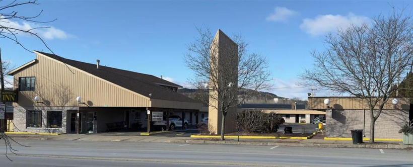
2. It was a Sunday. I needed to take care of everything at the motel I had called home for the previous five days in Mansfield, Pennsylvania. This consisted of packing thoroughly and carefully. If I forgot anything, there was little to no chance of me getting it back. I had a little more room in one of my bags because some of the clothing I had brought with me was used as the costume for the creature. Since it had been sliced up and coated with blood, there was no need for me to take it back home. I made sure to rearrange the furniture back to the way it was. I had moved a table to give me a setup similar to my desk at home. Everything was cleaned, the bed was made, and after checking for maybe the fifth time, I grabbed the room key and headed out. The manager wasn’t in the office, but he was at the top of the stairs, which led to his apartment on the premises. I made sure to get his attention as I dropped the key into the box. I didn’t receive any sort of negative email in the days after, so I assume I left the room looking fine. I sat in my rented Honda Accord and took a few breaths; the trip was almost over. I felt like I had lived a month in a week, and although there was still one shooting day to go, I already felt the dopamine crash that comes after you have an exciting experience and then have to get back to ‘reality.’ I pulled out onto the quiet Main Street as I had every other day that week, and made the drive to Mark’s house in the neighboring town of Wellsboro. I tried to soak in every hill and every curve, every shop and billboard, anything that might make a good entry in the blogs that would follow. Who knows if I will ever see that area again? If not, both Mansfield and Wellsboro were fine places to stay and spend a week.
Thank you, Mansfield Inn, it was a fun time.
3. I knew this final day was going to be something different from the moment I arrived at Mark’s house. On previous days, when I arrived, I parked my car in the grass next to his driveway. This let me leave at the end of the filming day without being blocked in or blocking someone else in. When I pulled up on this day, I hadn’t been there for more than a minute or two when Mark gave me the location where we were going on location to shoot. He said I could leave ahead of the rest of them to get some photos and videos. I enjoyed carpooling and connecting with the rest of the crew, but I was really craving some alone time, driving and playing the music I wanted while soaking in the new scenery. I took that chance. I punched in the location: Morgan Marine, Penn Yan, New York. Slowly, I pulled away and left Mark and his house in the rearview. It was time for our final rendezvous for The Cabin.
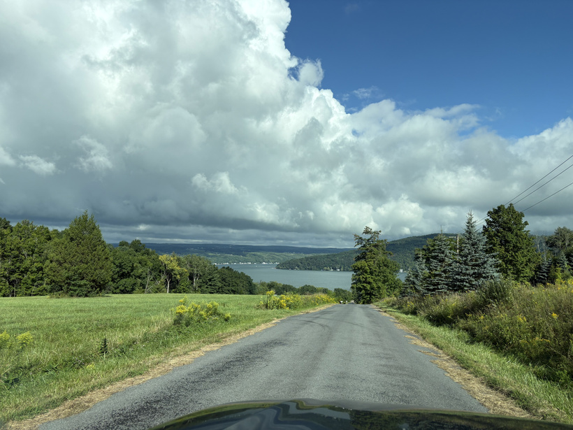
4. Each morning, when driving from Mansfield to Wellsboro, it was roughly 15-20 minutes of driving. I began this day with that drive. Getting from Wellsboro to Morgan Marine was about an hour and a half north. We were to be filming the final scenes of the movie on Mark’s boat and at a marina located on Keuka Lake, part of the Finger Lakes in New York. Things looked rough within the first half hour of the drive as the skies clouded up and it began to sprinkle. It was brief, though. The majority of the drive was beautiful, peaceful, and sunny. It made me wish I had some sort of GoPro, or other camera that I could have filmed the trek with. It was rolling green hills, small lakes, and good music, at least in my opinion. I wanted to make sure I had a little while at Morgan Marine by myself, so I was testing my luck with my speed. I was lucky in that I never had any sort of close encounter with police. Considering how much I drove on highways, I was a little surprised. Later on, though, I got to see someone else have an issue with the cops, but we’ll get to that. During my 90-minute drive north, things felt relaxed. I was thinking of all of the amazing things I had seen and done in the span of a week. That trip down memory lane was interrupted by a different feeling. In order to be ‘up’ for this final day, I began the morning with a slightly more potent energy drink. Within an hour of driving to the Finger Lakes, I knew I needed to find a bathroom. It became a battle between my desire to have some free time to shoot at Morgan Marine and my bladder telling me that wasn’t likely to happen. At one point I stopped my car to get a photo of an amazing view. I stopped right in the road. I very nearly took the chance to run into the grass to pee but wasn’t willing to risk it. The final leg of the drive was filled with a lot of leg bouncing just to keep my bladder distracted. Then, there it was, Morgan Marine. I made it. Before doing anything, I basically ran to the bathroom. Unfortunately, it was for members only and was locked. That was nearly the end for me, but I held it together and hustled over to the docks. There I asked a pair of teens who were working where the nearest bathroom was. I got pointed in the right direction, and within moments my nightmare was over. I calmly walked back to my car to grab my camera equipment to get some footage of the marina before everyone else arrived.
Yes I thought about running into the bushes to pee there.
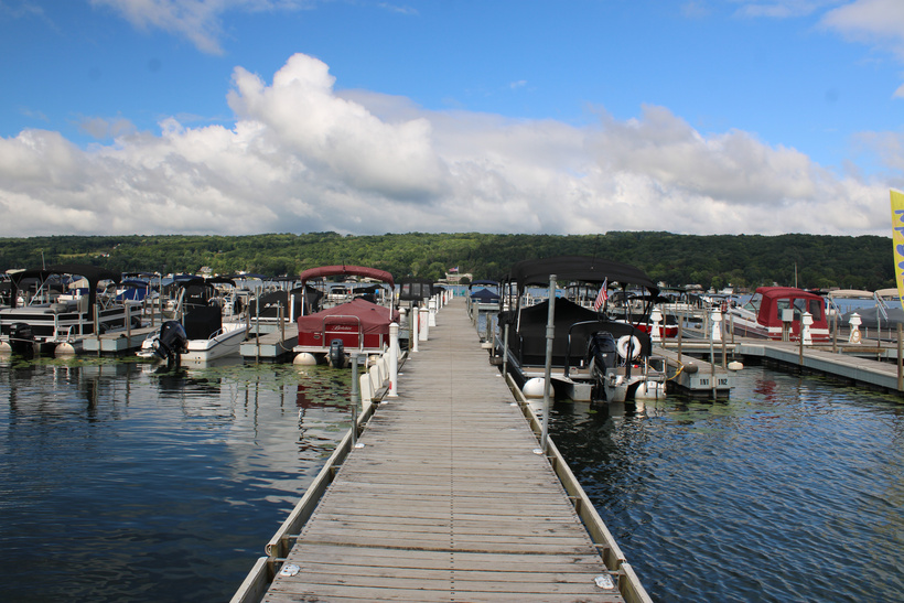
5. Throughout my adventure on this movie shoot, I did my best to stay in the moment and appreciate all of the new experiences I was having. As excited as I was, and am, for The Cabin to be a finished product, I was more keen on enjoying each memory as it was being made. I could have easily sat in my car and waited for Mark and the rest of the crew to arrive at Morgan Marine. It was, after all, a 90-minute drive early in the morning. I knew I’d regret it, though. Instead, I wandered all over the docks of the marina, capturing video and photos. I had never been to the Finger Lakes. Even though it would be brief, I wanted to get as much footage as possible so that memories, and blogs like this, would be chock full of details. There were dozens of boats docked, but surprisingly very few people in them. It ended up being a ruse. Only later on, when we were there filming and needed the appearance of isolation, did boat after boat of people come cruising by. It was a pleasant morning with partly cloudy skies and temperatures in the mid-60s. I wanted to stand and soak in all of the sights and sounds of the marina and Keuka Lake, but from in the distance I spotted the rest of the crew arriving, so it was time to get to work on the last scenes for The Cabin.
Some of the boats at Morgan Marine
6. In reality, we only needed a handful of scenes to be filmed. A few of them were on the docks, a few were in and around Mark’s boat, and a few were on the water. Luckily, when greeting the crew, I heard about us going out on the boat to shoot. I get terrible car and sea sickness, which is loads of fun. It leads to me doing most of the driving when going on any sort of road trip. It also means I need a fresh stock of Dramamine when I go on any car or boat adventure. I popped one pill and then hoped we’d take our time filming on the docks so that the meds had time to kick in. Cody, it turned out, wasn’t the biggest fan of the water. I offered him a Dramamine, but he said he’d be alright. As I just mentioned, only when we started filming did a seemingly endless stream of boats and even jet skis start to arrive and depart from the marina. The scenes are supposed to be in a very isolated area, so any sort of sound ruins the illusion. It was funny at one point I was filming behind the scenes, and Mark had to stop his own filming due to a plane going overhead. His giving the plane the middle finger had us all cracking up. Another laugh came when Jeff dropped his script on the dock, and a page went into the water. Fortunately, it was a scene we had already shot, so the sopping wet paper could be thrown away. The scenes on the docks went smoothly, so all that remained was getting some action shots out on the open water. By this time my Dramamine had kicked in, so I was itching to go. I just hoped Cody would be okay.
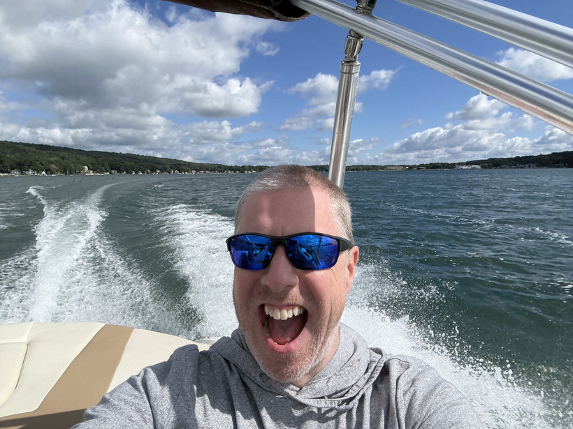
7. Keuka Lake is one of eleven lakes in the Finger Lake chain. It is unusual for its Y-shape. We were all the way at the northernmost tip of the eastern end of that Y shape. The lake is 20 miles long. I was hoping for a nice long cruise around but was also realistic. I knew we needed to get a few scenes on the water and that business came first. One scene included Jeff driving the boat. Mark had to get it going and then get out of the driver’s seat. Next, Jeff had to sit down and start driving carefully while also reciting his lines. My job was to sit, watch, and get some behind-the-scenes footage. I definitely had it easy. Once Mark got back to driving, we picked up speed and started cruising. I was thoroughly lost in the sights and sounds of Keuka Lake. I tried to get as many photos of as many lakeside properties as I could so I could remember the moments. It wasn’t lost on me just how much I had seen and done in such a short time. The airfield, the cabin, the university lab, the group dinners, the sunset chats in the front yard, and now a boat ride. There was so much to remember and talk about for so long to come. All good things do have to come to an end. After probably 20 minutes of cruising, we headed back to the marina. There was one final scene to be shot, and very fittingly I missed Mark saying ‘that’s a a wrap on The Cabin.’ I caught the last moment and had to then ask him to repeat himself, wicked smart. Jeff, Cody, and Michael headed back to dry land while I helped Mark put the cover on his boat. With each snap attaching the cover, I felt the reality sink in. My time on the movie shoot was ending. I knew it was meant to be a very full but also very fast shoot, but still it felt like it was over too soon. I savored each snap of that cover.
8. Despite the others quickly heading off to the parking lot, I knew they wouldn’t be going too far. One because Mark was driving at least some of them, and most of all because the end of the shoot meant it was time to dish out payments. This was a lot of fun. There I was pulling my bag out of the trunk of my rental car, whipping out my checkbook, and asking people how they spelled their last names. Without disclosing any numbers, because that would be lame, I will say that I ended up giving extra money to everyone who acted in the film. Seeing their hard work close up inspired me and made me feel like they deserved a little more than Mark and I had originally agreed upon. One by one, I wrote checks. I shook each person’s hand and thanked them for being a part of this project. I truly meant it. I had wanted to be a filmmaker since high school. I had written The Cabin book in 2008. So, standing there on the shore of Keuka Lake after wrapping filming and looking at these people who had chosen to be a part of the film, it was humbling and left me full of gratitude. Mark joked that I was setting the bar high with extra pay and all of the thanks. When the time comes to do a second feature film, I will still have that same level of gratitude. I hope I never lose it.
9. It was time for us all to go our separate ways. Being smart, I ran to the bathroom one last time. I watched Mark and the rest of the crew begin the return trip south to Pennsylvania. I, on the other hand, was staring at one of the longest drives of my life. Mark had said that driving to Keuka Lake would leave me 90 minutes closer to Cape Cod when it was time to leave. This was not the case. I actually was 90 minutes further away. It was nearly ten hours straight through. I needed a break somewhere in the middle. It was then that I realized that a spot I had wanted to visit for years was literally right on my drive home. It was the Saville Dam in Barkhamsted, Connecticut. This was only 5 ½ hours away and would allow me a built-in break to stretch my legs and get some long-awaited photos. It was just before 1 pm when I threw the address into my GPS, also remembering to avoid toll roads, and rolled out of the Morgan Marine parking lot to begin the very, very long drive back to Cape Cod.
10. I headed southeast through the rolling hills of Western New York. In an interesting twist, I ended up not seeing any deer on my long drives to and from Pennsylvania. When I had done a 6-day, 2,100-mile road trip around the Eastern U.S. in 2019, I saw so many deer in New York and Pennsylvania that it was akin to seeing squirrels along the roads on Cape Cod. What I did see a lot of on this particular drive was Pennsylvania Dutch people. I don’t believe they are specifically Amish. These folks were dressed in 18th-century garb and rode on the sides of the roads using horses and buggies. Even if I didn’t see the buggies, I knew they had been by since there were nonstop piles of horse poop all over the roads. It was truly unique to see what probably added up to a dozen such vehicles within the span of an hour. If I had not been at the start of such a long drive, I might have been tempted to stop at one of their roadside stores, but my rental car needed to be returned by 9am the following morning, and I had no plans of spending more money on another hotel stay. It was Cape Cod or bust, Pennsylvania Dutch or not.
11. When undertaking such a long drive, it is important to stay awake and alert. This is obvious. But how do you do it? Music, podcasts, and having a passenger are all good ideas. I tend to break things down into smaller bites. I’d use my GPS to break the trip down into chapters based around each new command. There were, however, long stretches of time where I had to force myself to pay attention. Much of the highways in New York and Pennsylvania were as rural as the road out to the cabin where we filmed. There was beautiful scenery everywhere, but sometimes no other vehicles in either direction. Then came the defining moment of my drive. In a patch of busier highway, I saw a car coming up on me. I was in the slow lane, just enjoying the drive. This car was speeding, and I knew this because a state trooper pulled behind them and put their lights on. I was both happy and sad since it wasn’t me, but that car was going to get pulled over. Or so I thought. Now, I don’t know about you, but if a cop puts their lights on behind me, I pull over as soon as possible. That’s kind of the point. I didn’t measure the distance, but I’d have to say that the car behind me drove for well over a mile without pulling over. Maybe they didn’t see immediately, but after going on two minutes, there was no way that person didn’t know a cop was on their tail. I was saying out loud that they needed to pull over. The cop was not happy and pulled into the other lane, right up alongside the car. They must have yelled and pointed because moments later the car pulled over. I don’t know how long you have to keep driving while a cop is on you with their lights going to qualify as fleeing, but this car had to have been close. I do not want to know how much their tickets were because I am assuming the cop gave them more than one because they were pissed off.
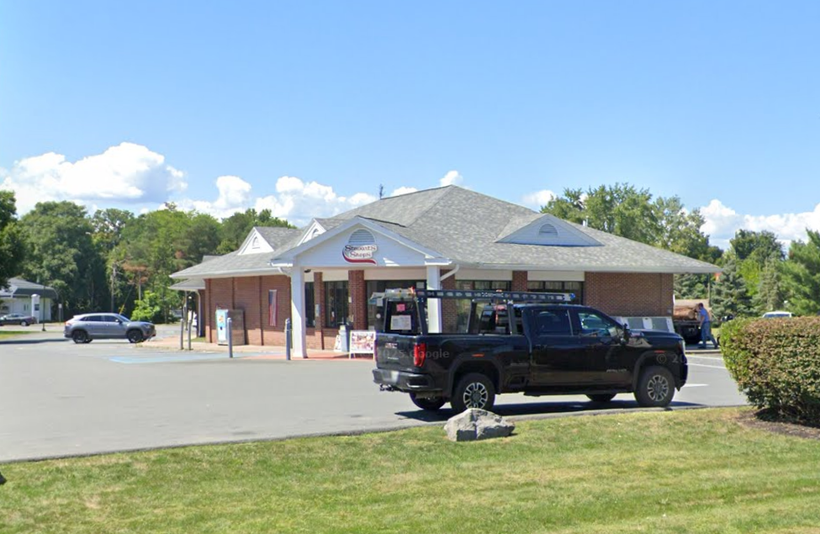
12. The drive back to Cape Cod was sunny and pleasant. It was a far cry from the monsoon that I drove through to get to Pennsylvania. The only times that I got off the highway were to use a bathroom at a rest area and then to find dinner. One thing that was a good and bad discovery while I was on this trip was the fact that I could use Venmo to pay for food. When I open the app on my phone, it is now littered with payments to McDonald's, because they are everywhere. For dinner, I stopped at a McDonald’s in the small town of Valatie, New York. It has less than 2,000 people and is about 20 miles south of Albany. I noticed that prices are somewhat lower for a lot of things in Pennsylvania and New York compared to Cape Cod. Saving a few dollars on food was good after the rental car, hotel, and other expenses of a week-long movie shoot. I sat in the parking lot just after 4pm, listened to a podcast, and did some people-watching as a way to recalibrate before continuing on the long drive home. By this point, I had already driven over four hours and nearly 250 miles and was still about 90 minutes from Saville Dam. There was no rush; I knew I had plenty of sunlight left in the day. Before getting back on the highway, I stopped and got gas at a Stewart’s Shops, which was right down the street. This was another place I’d never been. It’s a chain of convenience stores with more than 400 locations in New York, New Hampshire, and Vermont. After eating dinner, though, I had no desire to go inside and buy any food, so it was just gas up and go. Sorry, Stewart’s, you weren’t that important to me.
Here is the Stewart's Shops in Valatie, NY.
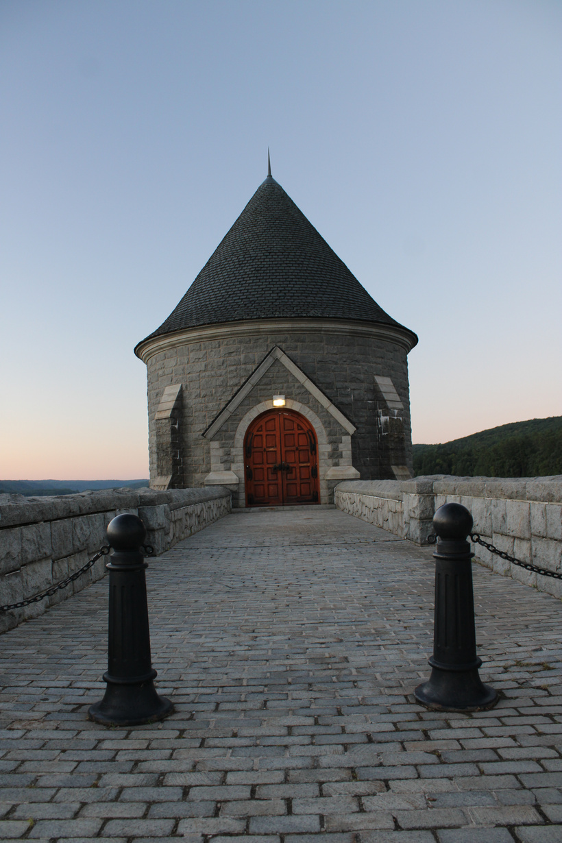
13. The anticipation built as I got closer to the Saville Dam. My fascination with the spot has lasted for years after seeing numerous photos of it on Instagram. Being about 3 ½ hours from Cape Cod, a drive out there wasn’t a quick trip, so it had to wait. Visiting it was the unexpected cherry on top of the sundae that was an incredible week. It was just after 7pm when I arrived. There was still a little time until sunset, leaving me plenty of opportunity to get all of the photos I wanted. I parked at the west end of the dam because it was the first parking spot I saw. If I had gone across to the eastern end, I would have been better prepared for the surprise that awaited me. In a public place, you have no control over who will be there or what they might do. I understand this. But there’s a big difference between families with screaming kids and what I saw here. At Saville Dam, closing in on 7:30pm on a Sunday, there were at least ten cars parked along the road in front of the beautiful gatehouse, which is the main photo point of the area. These cars were all owned by young people, probably in their late teens and early 20s. Oh, but they weren’t just parked. No, they were each taking turns racing by the gatehouse like a single-sided drag race. These idiots had no concern for any normal people who might have been driving that road or stopping to get photos of the area. I did my best to get all of the footage I needed. I can always overlay nature sounds on the video and mute the stupid cars. I stayed there for about 30 minutes, and by the time I left, it was almost dark, but the kids and their cars were still there. It was a weird mix because the Saville Dam itself was exactly as cool as I’d hoped, but the noise and foolish idiots racing there made it so I didn’t enjoy it as much as I might have if they weren’t. After sharing a few photos of the gatehouse on social media, it was time for the final push back to Cape Cod. 3 ½ hours of driving in the dark lay ahead of me.
The gatehouse at Saville Dam
14. I fully enjoyed driving the Honda Accord I rented. It had a lot of tech upgrades that my Toyota Corolla doesn’t have. There were LED headlights that turn from bright to normal depending on whether there’s a vehicle coming toward you. It felt good to finally give people a taste of their own medicine, seeing as how I have been getting blinded by LED headlights for years. They should be illegal. I enjoyed having the song display right in front of me along with the speed, plus the lane departure warning came in handy as it got later in the night. It also had a device charging pad located right under the radio. This was a great feature, but when you’re trying to see the GPS display and your phone is lying down, it became a bit annoying, so I didn’t use the charger as much as I thought. The next morning I filled the gas tank as is expected when you rent a car, and it made me even happier that I rented an Accord. Yes, the fill-up was a lot of money since gas probably costs double what it should currently, but it could have been much worse if I had been a fool and gone for the SUVs. I say that because the basic rental price of an SUV is less per day than a typical sedan, but you end up getting gouged on the gas. In the end, I would definitely rent that same type of Honda Accord again. Who knows, maybe when my Corolla is finally ready to be put to pasture (hopefully not for a few more years), I will buy one of those Accords as my next car.
15. The night drive through Connecticut, Rhode Island, and finally into Massachusetts was a war of attrition. I was just trying to make it home in one piece. In a funny twist, after seeing the Saville Dam for the first time, I ended up passing another spot that’s been on my New England photo bucket list. Jerimoth Hill in Foster, Rhode Island, is the highest point in the state. I have wanted to try to visit the highest points in all six New England states. So far I have visited exactly one, Mount Greylock in Massachusetts. I passed the sign for Jerimoth Hill at probably close to 10pm so I wasn’t going to hike to the top in the dark. Granted, it’s only about 811 feet high, but I’m not going to wander around a place like that in the dead of night. For a moment, I had thought that I put ‘avoid highways’ on my GPS because I seemed to be on a lot of local roads rather than highways. Finally, I found I-195 in Rhode Island, and it was smooth sailing home. I pulled into the driveway at 11pm. I had left Keuka Lake around 12:30pm. Yes, I stopped to pee, get gas, eat, and shoot the Saville Dam, but still it ended up being more than ten hours of almost nothing but driving. In total, I put more than 1,200 miles on that Honda Accord I rented. My Corolla at present needs some exhaust work and probably a few other smaller things. I couldn’t imagine having tried to pull that trip off in it. I’d probably have left it in a field near one of those horror houses in rural Pennsylvania.
16. I made it inside carrying all of my luggage in one trip. It was about all my body could handle. Even after driving for so long, I knew that I needed to take a few minutes to put everything away before simply collapsing into bed. I unpacked and drank some water. The next morning I needed to return my rental car by 9am. Only when I was about 7 hours into my drive home did I regret that decision. It all worked out for the best, though, as I saved money on an extra day of rental fees, plus however much I’d have needed to spend on a hotel room. The night ended the way most of my time on the movie shoot had; I did all I could, knowing that I’d have time to reminisce and enjoy it later. All of the photos, videos, and memories would be waiting for me in the morning. I had made it home after a marathon drive and a marathon week that felt like it had a month of memories crammed into it.
1.
I was at a self-checkout in a grocery store. All of the scanners were
full and most of them needed some assistance including me. An older lady(70ish) was standing at the entrance to the
self-checkout alcove holding only a newspaper. The employee in charge
of that area repeatedly asked her to come over so she could get
checked out before they went to assist with the rest of our checkout
issues. For some reason, the older lady didn’t want to go over to
the extra register. It ended up being like a person trying to feed a
wild animal, coaxing it with food, before the employee finally gave
up and flat out said in frustration ‘Why won’t you just come
here?’ By the time I was finally helped all of the other people at the self-checkout had been helped and that older lady with the newspaper
had also left before me.
2.
Pulled in the driveway where I live after dark. The homeowners had
just gotten home before me. As I walked from my car across the front
yard they turned on the outside light. That was enough to light up a
coyote standing twenty feet away next to a tree. Luckily my freaking
out to get my keys scared it away, but if the lights hadn’t come on
maybe I’d have been its chew toy.
Don't worry, it's just me.
3.
Did you know there’s no such thing as a seagull? Growing up on Cape
Cod I had always called the gray and white birds that live by the
water (and dumpsters) seagulls. In fact, most people call them
that. However in reality they are herring gulls and there is no such
thing as a bird called a seagull. Crazy. Here’s its ID page:
https://www.allaboutbirds.org/guide/Herring_Gull/id
4.
It’s still amazing how much warmer 50 degrees in February feels as
compared to 50 degrees in July. One day this week it was sunny and 55
on my way to work and all I thought as I stood on the beach was that
I must really like my job because it was a perfect day to suddenly
have a 24-hour bug.
Over 50 degrees at the beach on Cape Cod in February hits differently.
5.
Had my first infrared sauna experience this week. 28 total minutes in
140-degree heat. I sweat buckets which basically meant I had tons of
toxins I needed to get rid of. Also fun fact, my iPhone stayed with
me in the sauna (intentionally) and didn’t blow up, so that’s a
bonus.
Man it was hot inside that sauna.
6.
Getting on the highway I was stuck behind a blue minivan with New
York plates. The big issue came from the huge sheet of plywood on the
roof. It definitely got a little wobbly the faster they drove. I
didn’t want to end up in one of those Red Asphalt driver’s ed
videos so I passed them before the plywood could fly through my
windshield and pop my head off like a dandelion.
7.
I found an old journal I kept during my time living in Las Vegas in
2000-01. It’s amazing to look back now at 46 to the daily thoughts
from when I was 22-23 years old. Some problems were definitely not
problems. Some obsessions made me laugh and shake my head. I’m
about halfway through it and at times I feel like the narrator
answering questions I was asking then. Overall a good trip down
memory lane.
8.
The latest ‘my life is like an episode of Seinfeld’ moment.
Remember the guy with the terrible B.O. in Jerry’s car? Where the
smell stayed long after the guy left? At the gym, there is a man whose
B.O. pours out of him, even through a thick sweatshirt. It is so bad
that the stink cloud hovers over the treadmill he uses long after he
leaves. Like Jerry says it’s mutant B.O.
Only slightly exaggerating how bad the B.O. was
9.
I finally bought myself a new Blender shaker bottle. They’re great
for protein shakes and mixing other drinks for exercise, etc. Anyway,
I don’t know what the lifespan is on those bottles but I believe
that the one I just threw away I had for 12-13 years. Is that too
long? If it is let me tell you about a few gym towels I have that are
about the same age.
10.
Have you ever not heard a song for many many years and then you
listen to it and it instantly puts your mind back to where you were
when you were listening to it a lot? I had that happen the other
night with a song from the band Live. I hadn’t heard the song in
well over 15 years but as soon as it started playing my brain went
back to 1997 and the lyrics flooded my head. Music is so powerful.
It goes by many names, rotary, traffic circle, or roundabout. Whatever it is called it is a common part of daily life not only on Cape Cod but all across the globe. As of 2022, according to Lee Rodegerdt's book Roundabouts: An Informal Guide, there were roughly 9,860 rotaries, traffic circles, and traffic-calming circles spread across America with Florida having the highest number. For as commonplace as these are today they had to start somewhere and that somewhere was Cape Cod and more specifically South Yarmouth. The man behind America’s first rotary was Charles Henry Davis, a man with deep connections to Cape Cod as well.
America's first traffic circle at River and Pleasant Street in South Yarmouth, MA
Davis was born in 1865 and lived in Philadelphia, Pennsylvania as a child. His father and grandfather were both involved in road construction which led to him later in his life becoming co-founder of the National Highways Association in 1911 along with Coleman DuPont. The first initiative of this organization was to publish a map of a 50,000-mile National Highways network for the country. It also began the system of numbering major state roads as can be seen all across America.
Davis moved to South Yarmouth in 1902. He amassed quite a large fortune in the early years of the 20th century. This came about as his family owned several plots of land in the coalfield area of Harlan County in southeastern Kentucky. Davis bought up all of these plots as well as several pieces intertwined through these plots. This meant that he owned most of Harlan County as well as having the rights to its coal and lumber. He created the Ketenia Mining Company.
Charles Henry Davis(Federal Highway Association)
These land holdings proved valuable to Henry Ford the visionary automobile entrepreneur who was looking for a way to produce an affordable vehicle. Davis leased the entire Ketenia properties to Ford for ten years. Ford did all of the mining and provided Davis with a set price per carload of coal as well as a set royalty on each car Ford sold. This contract provided Davis with a mass of wealth that he put to good use.
Shortly after coming to the Cape Davis purchased land surrounding Bass River. At the intersection of River and Pleasant Streets in the South Yarmouth village of Bass River, he created two things to cement his legacy here. The first was his home.
Davis purchased a piece of property containing three old Cape-style houses and a barn. These buildings were connected into one forming a larger estate. Years later, after his six daughters were born, Davis added a sleeping porch and a runway to the already massive home. This made the house a complete square with a courtyard in the middle. It was known as the House of Seven Chimneys. Though it did have seven chimneys the home in its entirety had at least twice that number of actual open fireplaces. It also had 217 windows and 17 front doors.
House of Seven Chimneys in the early 1900s.(Historical Society of Old Yarmouth)
The House of Seven Chimneys was a unique and highly spoken-of property. It was featured in House and Gardens Magazine four times in the span of a year between 1908-1909. The compound had no electricity. However, it did have a cellar with furnaces and water heaters that ran under the entirety of the buildings. This was affectionately referred to as the ‘Bass River Subway.’
The second piece of Davis’ legacy which exists in Bass River is America’s first traffic circle. It was originally an old brick watering trough but was transformed by Davis to help handle traffic in the area. The signage denoting which road one is traveling on still stands today, however, the three ship lanterns which originally hung there to act as makeshift traffic lights were vandalized and have long since been removed. The rotary was known as the National Highways Circle paying homage to Davis’ role in the National Highways Association.
Despite having set up deep roots on Cape Cod, Davis did not stay put for long periods. He chose to travel extensively around the country in his Hudson automobile. This was decorated with forty-eight license plates, one for every state in the Union at the time, each with the plate number ‘25.’
Charles Henry Davis’ legacy on Cape Cod extends far beyond his estate and the country’s first rotary. In 1928 he constructed Ship Shops Marina, originally at the foot of his estate along Bass River. It now operates a half-mile north along Bass River on Pleasant Street.
Just across the river, the popular West Dennis Beach is named Davis Beach in honor of the man. He owned the entire property and sold it to the town for $50,000($589,900 in 2024) just before he died in 1951. He also purchased the Bass River Golf Course in 1946. In the 1920s it doubled as a dairy farm with cows roaming the links, though fenced in somewhat to keep them off the fairways and greens. At one point in time, Davis could walk from Nantucket Sound to Cape Cod Bay and never leave the property he owned.
Though not responsible for it, Davis was one of the first to propose a Mid-Cape highway. His proposed route along the ‘crest’ of the peninsula was not far removed from where the highway was eventually laid out.
In 1947 he proposed that one of the cornerstones of the new United Nations building be from Cape Cod, Debs Hill in South Yarmouth specifically. The sixty-ton boulder on the property of Fannie Holloway took more than two months to unearth and was not used for the project with then-Mayor of New York City William O’Dwyer saying that if the stone was brought to the city he’d have it dumped in the East River. Instead it today sits appropriately at a traffic circle inside the New Seabury development in Mashpee.
Davis' boulder at New Seabury.(Google Maps)
Davis died on June 3, 1951, in New York City at the age of eighty-six after two years of failing health. He left behind a huge legacy not only on Cape Cod but in the country as well. His contributions to the Cape are numerous yet slightly below the surface. Whether circumnavigating America’s first rotary in South Yarmouth, walking the sandy shores of West Dennis Beach, or driving any of the numbered routes across the United States Charles Henry Davis’ impact is difficult to ignore.
Cape
Cod in the summer can be a slog when it comes to travel. Even on the
most picture-perfect days weather-wise the man roads of Rt. 28, Rt.
132, and especially Rt. 6, can be choked with vehicles all looking to
visit the same locations.
In
the current era where GPS is common even the side-roads that used to
take locals away from the crowds are not of as much use. What can be
done to alleviate the traffic jams? Unfortunately not much. Route
28, Route 132, and the like are set in stone. As far as Route 6
goes, it’s not as if new exits can just be created to break up
traffic jams. Or can they?
For
decades the idea to do just that was a major talking point in the
Mid-Cape area. The ultimate goal of developing a new exit along the
highway has come close to fruition several times. Though not
currently in existence it is not far from the minds of those longtime
Cape Codders who look for ways to avoid the crush of summer traffic.
This is the story of the elusive Exit 6 ½.
What Exit 6 1/2 could have looked like.
The story of Exit 6 ½ is intertwined with the history of Hyannis’
Independence Park. Located in between Rt. 132 and Mary Dunn Road,
the industrial park was originally 680-acres of highly sought after
land. It began its life as Parkland Properties owned by Paul Lorusso
in the early 1960’s.
Lorusso,
who had risen to prominence on Cape Cod in the 1950’s by creating
affordable housing for World War II veterans, had to battle for a
decade to get Parkland Properties to officially open as Independence
Park in 1975. The first official tenant of the property was Marken
Brothers grocers wholesale outlet.
More
and more businesses opened up in, or moved to, Independence Park.
Being somewhat quieter nearly a half century ago it was only natural
that Lorusso would look for ways to increase vehicle traffic through
the enormous industrial park. This is where Exit 6 ½ first comes to
life.
The
first idea Lorusso had to bring more eyes to Independence Park was
via extending Old Townhouse Road in West Yarmouth. In 1975 the road
ended at an intersection with West Yarmouth Road. Lorusso had the
thought to extend Old Townhouse Road west nearly three miles. It
would intersect Higgins Crowell Road and ultimately end up connecting
to Mary Dunn Road which abutted Independence Park. In an attempt to
push the project through Lorusso even offered to have his company
foot the bill for the road extension. This would have cost Lorusso
an estimated $800,000($4.27 million in 2022).
In
early 1979 local newspapers ran stories about ways to alleviate the
increasing traffic in and around the Mid-Cape. In addition to
mentioning the extension of Old Townhouse Road again the story
mentioned the creation of a new highway interchange between Exits 6
and 7 on the Mid-Cape Highway. Preliminary specs called for the
so-called ‘Exit 6 ½’ to be constructed at the Mary Dunn Road
overpass.
Paul
Lorusso was a big proponent of the new interchange as it would
shepherd vehicles right through Independence Park. The fact that it
was being mentioned as being mostly state and federally funded made
it an even better idea. Concrete plans for a new exit went slowly
with potential water quality issues around the interchange becoming a
major sticking point.
In
1981 the Old Townhouse Road rumor sparked back up. When nothing came
from it this time it was shelved. A few years later it was decided
to use the open space to create the Bayberry Hills Golf Course which
opened in 1986.
A
study in 1983 showed there were an average of 30,000 vehicles per day
in the summer passing in the vicinity of the Barnstable Airport. The
data was there that something was needed to give at least a little
relief to the traffic. Momentum seemed to be rising when in 1984
rumors started to swirl of plans to build a new hospital in Hyannis.
This was seen as a perfect fit for Independence Park. The addition
of the hospital on the grounds could make the creation of Exit 6 ½ a
little easier. At the time at least one person interviewed in the
newspaper felt confident that at least one next exit would be created
for the Mid-Cape Highway within the coming decade.
None
of those plans came to fruition and the chatter about Exit 6 ½
quieted down. It bubbled back up in 1992 this time with an idea to
remove the Airport Rotary as well. Then-Massachusetts State
Representative John Klimm wished to have plans for the maligned
highway interchange drawn up to potentially be included in a major
state transportation bond bill in 1993. In August 1993 the
Barnstable Town Council finally endorsed the creation of Exit 6 ½.
A major hurdle had been crossed.
It
was rumored that even with state funding that taking the interchange
from planning to finished product could take as long as ten years.
The rejection of a proposed Sam’s Club store in Independence Park
in February 1994 was an ominous sign for Exit 6 ½. Despite that one
million dollars was set aside in the state transportation bond bill
for design studies and environmental impact studies surrounding the
proposed new highway exit.
The Exit 6 1/2 plans from 1998(Barnstable Patriot Archives)
Plans
changed when in June 1994 the state purchased 357 acres of
undeveloped land that was part of Independence Park via eminent
domain for $5.2 million. This land was to be protected and threw a
huge monkey wrench into where a potential Exit 6 ½ could
realistically be built.
A
feasibility study was conducted in 1995 and public support was
sought. Besides the potential environmental concerns those who lived
along Mary Dunn Road and the surrounding neighborhoods felt the new
interchange would add traffic to their relatively rural area. Talks
would heat up and cool down over the next several years. Alternative
locations for the exit were discussed as well as other ways to
alleviate the thick traffic along Rt. 132.
Finally
in March 1998 an official design for Exit 6 ½ was approved by the
Massachusetts Highway Department. It was all systems go. Or so it
seemed. Years passed and no movement was made on Exit 6 ½. It
remained stalled in the planning stages. By 2002 focus had shifted
to widening Rt. 132 and talk of Exit 6 ½ slowly faded away.
Twenty
years after talk of Exit 6 ½ faded into the background traffic in
Hyannis, and on Cape Cod in general, in the summer has only
increased. In a report from the Cape Cod Commission, in 2018 the
total number of vehicles crossing the Bourne and Sagamore bridges on
an average day was 131,583. With traffic woes as prevalent as ever
perhaps the talk of a potential Exit 6 ½ will bubble to the surface
again sometime in the near future.
The
Mid-Cape Highway, known as Route 6, extends 63 miles across Cape Cod
from the foot of the Sagamore Bridge to Herring Cove Beach in
Provincetown. It passes through every town on Cape Cod except for
Falmouth, Mashpee, and Chatham. First designated in 1926 this road
has been consistently improved and redeveloped over the subsequent
century. It is now the main highway and busiest road on the Cape.
Throughout
its lengthening and widening, eventually connecting the entirety of
Cape Cod Route 6 has remained a quite normal highway. It is a
double-barreled road from Sandwich to Dennis, while becoming more of
a traditional surface road between Eastham and Provincetown. However
there is one section of Route 6 that has become a world unto its own.
This 13-mile section connects Dennis to Orleans and has been witness
to an unusually high number of fatal auto accidents. So much so that
this section of road has had its own unique and chilling nickname.
It is known by locals as 'Suicide Alley.'
This
section of Route 6, extending the highway to the Orleans Rotary, was
initially completed in 1959. In 1954 the highway was widened from two to four lanes up to Hyannis, it took until 1971 for it to be widened to four lanes into Dennis. However that was where the widening stopped.
The section between Dennis and Orleans remained two lanes, one in each
direction, and has right up until the current day.
The Mid-Cape Highway in the 1950's.(Sturgis Library)
Initially
this two-lane highway maintained the 55mph speed limit of the rest of
Route 6 up to that point. To allow faster traveling vehicles an
easier time 22 passing zones were also included on this part of the
road, meaning it was possible for passing vehicles to be face to face
with those coming in the opposite direction. Likely sensing
impending doom the Massachusetts Department of Public Works discussed
plans to widen Route 6 to four lanes all the way into Orleans. However
environmental concerns halted these talks by 1974. The proposed
widening would impact some wetlands, several ponds, and potentially
town drinking water. The state did lower the speed limit from 55 to
50mph in 1974. This did little to slow the increasing rash of severe
accidents.
It
was not until the late 1970's that this part of the highway got its
morbid nickname. First seen in a printed capacity in 1979 'Suicide
Alley' was bestowed upon the 13-miles of road. This was due to the
high number of fatal vehicle accidents. Between 1973-1979 alone
there were 17 deaths and 174 injuries along Suicide Alley. It was
easy to understand why as the two lanes had hardly any separation
between them with vehicles commonly traveling far above the posted
50mph speed limit. This was a cramped section of road where on an
off-season day the highway can see upwards of 55,000 vehicles. It
only exacerbated in the summer when those numbers could easily
double. Traffic jams heading west on summer days are frustratingly
normal even to this day.
In
1979 there were renewed talks over widening Route 6. The
environmental concerns were raised again though the idea of getting
the towns involved (Dennis, Harwich, Brewster, and Orleans) on the
same page seemed to be just as difficult. It was said at the time
that a 'united front' would help get the project funded. By 1981
again talks had quieted down. Instead locals gave ideas on how to
make Suicide Alley safer without widening it. Some of these included
traffic lights at all on ramps and a concrete barrier along the
entire stretch of road. The barrier was also nixed due to
environmental concerns.
An
interesting note on Suicide Alley was the fact that despite the
fatalities along it being higher than the state average for highways,
the number of accidents in general was lower. In the mid-1980's some
state police officers referred to the Dennis to Orleans section of
highway as the most dangerous road in Massachusetts.
'Suicide Alley' in Brewster c.2005
An
environmental impact study was green-lighted in January 1986 with a
Route 6 task force suggesting again to widen the highway to four lanes
in September 1986. In addition to the environmental worries some
locals theorized that a wider Suicide Alley could lead to a faster
development of the areas it passed through. This time though the
project actually gained steam. By the end of the 1980's 36 people
had died on the road in the previous two decades. The tipping point
was the horrific accident in April 1989 when Brewster mother Lois Ann
Scholomiti and her 2 children died in a head-on collision with a
truck.
In
an attempt to appease all sides a $7 million($13.7 million in 2021)
project was completed in 1991. A three-foot wide berm(artificial
embankment) and three-foot tall reflectors were added for the entirety of
Suicide Alley. The passing zones were also removed and the two lanes
slightly widened. Despite these safety improvements the talk of
making the road four-lanes remained and had its closest pass to date in
1994.
The
Massachusetts Highway Department submitted three proposals for the
maligned Suicide Alley. They all included some form of widening the
road, though each with different end points of said widening. A
'full-build' to the Orleans Rotary was estimated to cost $45 million
($81 million in 2021). The project even had design plans drawn up by
the Highway Department. In the nearly 3 decades since though the
project has never moved beyond design plans and speculation. It must
be said though that the two Cape Cod Rail Trail bridges over the
highway in the years since have left room for the addition of more
lanes.
The proposed changes to Suicide Alley in 1994(Mass. Highway Dept.)
For
more than 40 years a 13-mile section of Cape Cod highway has been
alternatively known as 'Suicide Alley' by locals. Is the name
justified? There are drivers and police alike who say it is not.
The Bourne Scenic Highway is one such road seen as more dangerous
than Suicide Alley. According to a study by the Cape Cod Commission
in 2004 the crash rate on Route 6 in Eastham is the highest, nearly
triple any other section of the road, including Suicide Alley.
Those
safety measures implemented in 1991 have reduced the accident rates
on the road. However the rumblings of extending the four-lane Route 6
all the way to Orleans are always just below the surface. Anytime a
terrible accident occurs, or a several-mile traffic backup occurs in
the summer, those talks will again come bubbling up. Until it is
officially no longer two lanes 'Suicide Alley' will maintain its name
among locals, even if it has not been truly fitting in three decades.