Pages

Showing posts with label canal. Show all posts

Monday, March 16, 2026

Initial Impressions 2.0 Blog #112: March Weather, Repeating Timelines, Cape Cod Adventure, etc.


1. It’s amazing how much warmer warm temperatures feel when coming out of a cold winter. This week, we touched 60 degrees on Cape Cod. If you had told me it was 75, I’d have believed you. Being stuck inside working all day, I was itching to get outside into the sun once the day was over. I had an important phone call to take, and I decided rather than sitting in my car, I’d hit up the famed Monday Runday track and do some walking while talking. It was almost perfect. The track had a few snowy patches that had not been hit by the sun, but otherwise it felt just like it did last time we did Monday Runday back in October. In all, I walked a little over 1.5 miles and burned around 200 calories. Not bad considering I could have sat on my ass in my car and burned nothing at all.


2. March is the most bipolar month there is in terms of weather. You can get days that are in the 60s and sunny, and within the same week, have temperatures hovering around freezing with the threat of snow. Obviously, that is what we got this week. I think growing up in New England has conditioned me to get out and fully enjoy the warm days of March since it can quickly go the other way. I think April is a bit like that as well, at least at the beginning of the month. It’s only when we get to around the first of May that we on Cape Cod can fully relax and enjoy spring without the looming threat of a secret frost or snowy day.


3. Incredibly, my story of the tough dealings with the editor of the short film I co-produced did not end last week. After agreeing to double the pay of the editor just to get the film finished, this guy decided to get greedy. The next day, he asked for more money again. He asked if I could get the donors for the When Henry Met Henry film to just cough up some more cash for his ‘expenses.’ Like what? We gave him instructions to use copyright-free music and find royalty-free b-roll footage. Not sure what his ‘expenses’ were. In the end, I set a hard line and said he’d get the money we agreed to for editing the film, or he’d get half if he sent me all of the raw footage and walked away. Not a bad deal. I don’t know if he thought I’d roll over at his attempts to hijack the film, but that didn’t happen. He ended up agreeing (yet again) to the money and to get the film done. I wasn’t a complete ass; I did give him an extension on the deadline until the end of March. I will say, it felt good to stand up to someone trying to screw me over. I might have to do it again sometime soon.


4. My niece Sylvie gave me a makeup case cell phone. It’s a cute pink plastic phone with different lip gloss inside. I began thinking of how I could use it in a video. I came up with a story of me being lost in the woods without my phone and remembering the phone she gave me, only to discover that it’s makeup. I went to a local conservation area with ideas for shots that I could then edit into a 2-3 minute funny horror video. Of course, shooting some scenes where I am scared and calling out for help would be best done with nobody around. I got some basic b-roll video as I walked the paths. Then I got set up for a shot of me wandering the woods while my phone was on a tripod, capturing the scene. Right on cue, came an older couple who appeared to be birdwatching. There I am, standing off in the woods, positioning my phone. They were curious, but I just said hello. Thankfully, I didn’t have to explain to them what I was doing. Shooting skits with my camcorder at 17 was cute and creative. Shooting skits, by myself, in the woods, at 48, might end up with a call to the nuthouse. 


5. One of my favorite things to do for my podcast is to craft unique alternate logos and cover art. I try to capture the nostalgic vibe of the 60s through the 90s while also keeping the basic layout of the logo. I made a pair of them in the past week. As you can see, they both have the classic, typical 70s avocado color palette. I went with two uniquely retro backgrounds. One was the faux wood paneling that I fondly remembered from my Nana’s house growing up. The other was one of the oddly paneled tiled kitchen floors. I believe we had this in one of our kitchens growing up. There is another tile setup that was super 80s, but I’m saving that one for a future podcast logo.


6. An interesting phenomenon that happens way more often than I think has to do with where I go for photography on Cape Cod. I will have an idea of a place I want to go shoot, and I’ll go there. No, that’s not the interesting part. What happens is that many times now I go to a place, and the next day I have photos of that same place in my social media memories. It’s like my subconscious takes me to the same places at the same time each year. It happened this week when I went to get some videos of the bridges at the Cape Cod Canal. The next morning, I was going through my Facebook memories, and there it was, a post filled with photos of the same bridges from 2016. I definitely don’t choose to visit the same places on the same days, but man, does it happen a lot.


7. On that photo trip I just mentioned, I came across a massive flock of Common Eiders, which are sea ducks that are usually black and white. They were hanging out in little crevices along the Cape Cod Canal as the tide was flowing out. When I say a massive flock, I’m talking a few hundred. They typically hang out in a cove at the western end of the canal across from Mass Maritime Academy. It was fascinating, and I found myself trying to get close-up video of these ducks. Naturally, they found me as a threat and would fly further down the canal. Once they’d realize I wasn’t trying to hurt them, they’d stop just far enough away. I kept walking toward them, filming them flying away and landing just enticingly close enough that I’d keep going. This game was repeated a few times. I ended up with several videos of duck wings slapping on the water. I guess it will be good for people who enjoy nature sounds and ASMR.


8. On this same one trip, I ended up with five or six great videos in probably half an hour. While filming a ship passing by, I noticed in the distance that the railroad bridge was lowered. It typically sits 135 feet above the water when raised. It gets lowered a few times a day for trains to pass over the canal. I saw it lowered and knew a train would pass by me in a few minutes since the railroad tracks run along the canal. I was at the Bourne Recreation Area, which sits directly under the Bourne Bridge. I had a minute or two to decide how I wanted to film the passing train. I wanted a cool perspective, but also didn’t want to risk damaging my phone or myself. I settled on filming from the platform where people could board the train. I set up my phone on a tripod in the perfect position and waited. I knew the train wasn’t stopping, so I didn’t have to worry about the conductor getting mad that I was faking them out like I was going to be a passenger. The train approached, blew its horn, and passed by. It rumbled with such force that the phone shook as it passed, maybe less than 10 feet away. The video was great except that I thought it was going to be a big half-mile-long train, but it was a little stubby one with maybe four cars. Oh well, I was lucky just to be there in that moment, so I’ll take it.


9. This week, for the first time probably since I was a kid, I had cream soda. Well, actually, diet cream soda, but still. Have you ever had something that you loved as a kid but got away from it? Foods, drinks, activities, maybe music? I can’t remember when I stopped drinking cream soda as a kid, but obviously, it happened at some point. I was at the store and walked past it, and wondered when the last time was that I had had it. Weird how something can be your favorite and then just not. I’m sure as a kid, I loved the sugar of the regular cream soda. I can’t do that anymore; it makes me feel terrible. That being said, the diet cream soda was good, so I’ll be making it a part of my drink rotation going forward. Who knows what the next thing from my youth will be that I bring back? My guess is something to do with a flannel shirt.


10. I constantly have to shake my head at the people who complain about a certain social media site from that site. Like, if you go on Twitter(X) and constantly mention how you hate it there, you know what you do? Delete your account and go somewhere else. It’s not hard. You didn’t sign a lifetime contract to remain miserable on a site you hate. You know how I know this? Because I deleted my Twitter account when I got sick of how much of a cesspool it was filled with toxic scum and bots. It’s the same with a job. Unless you’re under contract, you are not being forced to work somewhere you hate and are miserable. Just remember, you are not obligated to be on social media. I grew up in the 90s without it. If tomorrow all social media sites vanished, it would take a little while to get used to, but I’d be fine. It’s mostly just people who are so desperate for attention that they post how they hate whatever site they’re on for engagement farming.


11. Few things are more fun for me than exploring the lesser-known and hidden pathways of the Outer Cape in the offseason. Venturing out to Wellfleet and Truro in March allows you almost total freedom to go wherever and see whatever there is to see. I hiked through the downed branches to visit the Jenny Lind Tower located in the woods near the old North Truro Air Force Base. I wanted some video of the AFB, so I headed toward the chain link fence behind the tower that surrounded the base property. I thought I might be able to follow the fence back to my car. It was mostly true. I got some footage on my way, but also had to bushwhack through a lot of brush. I had a chance to slide under a gap in the fence to get onto the base property. After being sliced and diced by broken branches and thorns, though, I figured with my luck, I’d end up gutting myself sneaking under the fence. Despite it being March, I ended up with several small ticks on my pants. Thankfully, I noticed one and did a more thorough check. Those dang things are going to be a menace this summer.


12. Another adventure from the same trip was something on my ever-dwindling Cape Cod bucket list. Close to a beach in Truro, there is an FAA beacon on a hill. I am being intentionally vague about its whereabouts since I don’t want to get anyone in trouble if they go to seek it out. I ventured through a small but worn path that led up the hill and eventually to a clearing where the beacon stands. I had noticed the location on Google Maps and had wondered for years how to get there. I decided during this trip to wander the parking lot of the beach, looking for a path. Once I found it, I made my way uphill, making sure to stay low and as inconspicuous as I could. I made sure that when I emerged from the clearing, for as much footage as I got, I stayed far enough away. You don’t want to get too close, just in case cameras are rolling. Even if you just take photos from a distance, staying on the edge of the clearing is the wisest move. Getting to see this FAA beacon checks off one of the very few places I have yet to see on Cape Cod. The biggest one remaining is Monomoy Lighthouse in Chatham. We’ll see about making that happen.


Monday, October 27, 2025

Initial Impressions 2.0 Blog #92: One Brain Cell, It's Me Shawn, Papa Gino's Meeting, etc.


1. While entering the supermarket, I caught the sounds of the excellent 1980s song ‘Take On Me,’ by A-ha. Growing up in the 80s, there’s no way I wouldn’t know the lyrics. It sounded different because it was an acoustic version of the song. A woman working one of the registers stopped ringing up a customer to loudly complain about how whoever was singing was ruining the song. She then kept complaining by saying the original is such a great song (truth) and these people should leave the song alone. I had to laugh to myself because the version of the song was an acoustic version BY A-ha. So this lady was shouting into the air about how A-ha was ruining A-ha’s song. I didn’t bother saying anything because she looked like she gets lost in a closet, so trying to explain what I just wrote would have fried her brain cell.


2. Ladybugs are supposed to be good luck, and you can make a wish while holding one and let it fly away and maybe it will come true. That being said, we had one inside at my job. I caught it and brought it outside. I made a wish and let it fly away. Only it flew right back and landed on my shirt. How far does the ladybug have to fly away to break the plane of the wish? Is it like crossing the goal line in football? It was crawling down my shirt so I ended up bringing it back inside with me and putting it in one of our plants. I’ll have to try again to make another wish on it this week.


3. In a follow-up from last week. I did in fact make a behind-the-scenes video for the When Henry Met Henry film. Last week I mentioned being halfway through recording on my webcam when my recording software decided to crash. Later that same day I took my phone and my selfie stick and did a walk and talk. I went to the local bike trail so that I could have some fall aesthetics and nature while discussing the filming process. I was pleasantly surprised that the vast majority of the video went off without a hitch. Granted, there were a few people on bikes but I just paused the video as they approached. The low light of the recording was the pain in the ass kid on his little dirt bike riding up and down the power lines right off the trail. That was an editing challenge. The highlight was the walk itself but also the blue jays yelling as I walked. I find recording at my desk boring and only do it when necessary. If possible, I will try to be outside, or at least somewhere different to give each video its own personality. Speaking of which, here is the finished When Henry Met Henry Behind the Scenes video.


4. Since giving up alcohol 5 years ago, I mostly drink flavored seltzer water. One beverage I will indulge in every now and then is birch beer. If you’ve never had it, the drink comes from the sap or bark of birch trees. I can only describe its taste as a mix of wintergreen with a hint of cinnamon. I can’t remember who in my family liked it, but it is from them that I first tried it. In trying to stay relatively fit in my late 40s, I will drink the diet birch beer, usually from Polar. A liter bottle runs 10 calories. Having drunk unsweetened drinks for many years now, I can tell when something is loaded with sugar. This week I got some birch beer and, within two sips, knew it was regular and not diet. A liter of the regular birch beer runs 410 calories. That’s a big difference so I sadly didn’t finish the bottle. Then, when I went to get diet Birch Beer I saw why I made the mistake. The regular and diet and right next to each other in identical bottles but the kicker is the color. It’s white letters on green-ish white background. I literally had to pull the bottle close to my face like I was 90 to see if it said diet or not. Oh well, at least I got the right one that time.


5. When I go for a walk or run, I wear big over-ear headphones to really get immersed in whatever music or podcast I have going on. That means that I also need to pay attention to my surroundings since the headphones can cancel out any noise. That came back to haunt me this week, but not in a bad way. So I was on a walk and going around the periphery of a golf course. No, I didn’t get hit by a ball. I was walking and I felt something slam into my right arm. This scared the hell out of me and got my heart rate jumping. I spun around, not sure what I’d see. What I did see was the cutest white Golden Retriever. It was a few hundred feet from its owner, whom I did see slowly walking up. The dog must have gotten so excited to see me but when I paid it no attention due to my music, it decided to really let me know it was there. And yes, before continuing on my walk there were copious amounts of belly scratches for the dog.


6. On a break from working, I grabbed my phone, selfie stick and my yearly mini-pumpkin and headed to get some photos. I ended up at the Cape Cod Canal and started wandering around the grounds snapping photos. Everything was normal until I started walking along the water, headed for a marina. I saw a guy fishing and he gave me the side-eye. At first, he joked to me that my photo would be better if his ‘fat old ass’ wasn’t in the way. I smiled and he said, ‘hey it’s good to see you again.’ Now I was confused and asked, ‘really?’ The guy said, ‘yeah it’s me Shawn. I saw you here before not that long ago.’ I told him it definitely wasn’t me, but I was polite and wished him a good evening before going for more photos. No idea who that guy was, or more importantly, the guy who looks like me who is creeping around the canal. Maybe it’s old me from the future coming back to take photos at the canal.

One of the photos taken along the canal.


7. This week, the NBA and the country have been rocked by a gambling scandal involving, as of this moment three people. Damon Jones, who was an assistant coach. Chauncey Billups, who is the head coach of the Portland Trailblazers and a former Boston Celtic. Lastly and the one that has raised my eyebrows is current Miami Heat player Terry Rozier. For those who don’t know the story here is a link to an overview. The reason Rozier got my attention is that he’s accused of point shaving. Basically, betting on the under on his own stats and then allegedly feigning an injury, or having an ‘off night’ to win money on those unders. One NBC Boston analyst mentioned Game 7 of the Celtics v. Cleveland Cavaliers in the 2017-18 Eastern Conference Finals. Rozier went 2-14 from the field, including 0-10 from 3-point range in 36 minutes of play. The Celtics lost 87-79. My mind immediately went to Rozier intentionally having an off night to win his bets and cost the Celtics a trip to the NBA Finals. Maybe it was just a coincidence but with Rozier’s gambling history, it seems like it sadly could be possible. I’m not saying the Celtics would have won the championship. Hell, the Cavs with Lebron James got swept 4-0 by Golden State. Still, you never know and that’s the worst part. Also, it sounds like this is just the tip of the iceberg, so grab your popcorn.


8. Sometimes I go seeking an adventure, other times the adventure finds me. I was out with my pumpkin, grabbing some Halloween-themed photos at an old mansion. It’s on a quiet road near the beach but is almost always deserted, which allows me to take my time setting up shots. I parked in a lot that is fairly hidden. I thought there might be a path so I could walk to the beach without having to get on the actual road. There wasn’t one, but there was a smaller overgrown parking lot, which I took a photo of so that I might be able to find out what it was used for. On the way back to my car, I spotted what looked like a decaying house about 50 or so feet back in the woods. Obviously, I needed to go check it out. Unfortunately, there was no path to it. This meant that I needed to bushwhack my way through the trees and brush to get there. It was a mess inside. There was a lot of graffiti as would be expected. There were also holes in the floor exposing water underneath. Luckily, I caught myself before falling through the floor but it was close. It’s a bit rundown and somewhat dangerous, so I wouldn’t recommend going inside. I got a lot of photos and videos, which I put together into a little Halloween adventure film so that you can see what it’s like.


9. We are in the hurry up and wait portion of the new bike trail extension near where I live. I’ve mentioned before that it begins just after a golf course and will likely go 4 extra miles. This will allow people to theoretically ride their bike from Wellfleet all the way to the Cape Cod Mall, nearly 30 miles. In the past few weeks, I noticed that the extension has been paved. I don’t know if it’s all the way but I did walk a half-mile or so down it. You’d think it’s nearly ready to be open to the public, but you’d be wrong. If the most recent bike trail extension, which connected the main trail to the golf course where it now ends, is any indicator, we’re looking at a year or more to go. The last extension was being worked on for at least 5 years from the time they removed an old railroad bridge to the day it was opened. Why does it take so long? I mean if you can get it paved that fast, why not just hurry up and finish it? Whatever, I’ll still use it even if it’s not ‘finished.’


10. The big news of the week is that come this time next year I will have had a script of mine made into a feature-length film. There is still so much to iron out, and I can only share a little right now, though. I met with the director of the film I acted in earlier this year, Cape Cod Cthulhu. He and his crew were on Cape Cod this week filming a new movie. 5 of us met for dinner and a chat at Papa Gino’s. I hadn’t had that for years so that was already a plus. We then started talking about a story I had written over 15 years ago. It fits 2 great categories: simple and cheap. We won’t need much for cast or sets, which means that the budget should be fairly low. The tentative plan is to shoot late next summer, so obviously, there won’t be a finished film for quite a while. Still, this is a big thing to have on my resume, being the producer of a feature-length film. It’s a really exciting new project, and the pizza at Papa Gino’s was good. Oh, and the director thought I was in my early 30s, so a great time overall.


Friday, May 12, 2023

In Their Footsteps: Cape Cod Summer Vacation 1923


    You’ve finally made it. After a long cold winter, the warm weather has arrived. It is time for a trip to Cape Cod for a summer vacation. You pack up the car and the kids and head for the Cape but this is not 2023. No, you are heading for a vacation on Cape Cod in 1923, one hundred years ago. What did a trip to the Cape look like back then? Let’s find out.
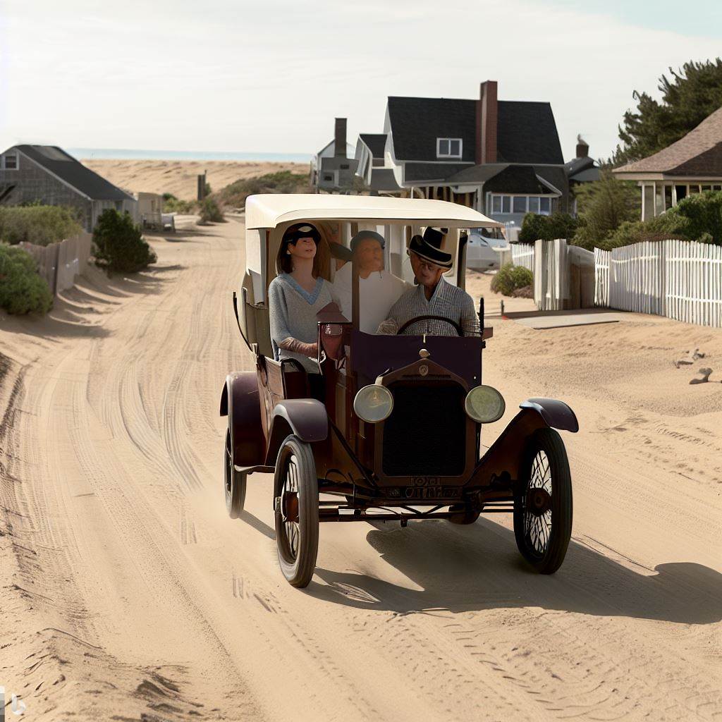
    First and foremost do you have your own vehicle or do you take a train? If you have an automobile you are one of the lucky ones. It would take until 1930 for more than half of American families to own automobiles. If you had a vehicle it was most likely the Ford Model T as 1923 was its best year for sales with more than two million units produced in that year alone. Other popular vehicles included the Chevrolet Superior and the Dodge Brothers Touring Car. These cars were quite different from the vehicles of today, with their exposed engines and spartan interiors.


    As you approach the Cape Cod Canal it looks different. The canal, which by 1923 had only been in operation for nine years, was still at its original width of 100 feet. It would not reach its present-day width of 480 feet until 1940.
    Naturally, with a narrower canal, the three bridges that crossed it were also different. The Sagamore and Bourne Bridges were drawbridges in 1923. Both bridges consisted of two 80-foot cantilever sections that rose to allow vessels to pass through. The railroad bridge was a 160-foot cantilever bridge that pivoted upward on its north foundation. These three bridges remained in use until 1935 when all three were replaced with the current bridges.
    You have now made it onto Cape Cod. There are fifteen towns and 143 unique villages. A major difference you will notice after crossing a bridge is that there is no Mid-Cape Highway. It won’t be until 1950 that the highway opens from the Sagamore Bridge to West Barnstable. This was Exit 6, present-day Exit 68. It is a slower go of things getting around on the Cape in 1923. Luckily Route 6A, then known only as the Old King’s Highway, existed to bring people all the way out to Provincetown.
    The big question now is where are you going to stay during your summer vacation? One thing Cape Cod did not lack in 1923 was popular resorts and hotels. In fact, the world-famous Chatham Bars Inn existed back then, although on a far smaller scale. If you couldn’t find room at CBI there was no need to despair.


    Some of the iconic hotels that you could have stayed at in 1923 included Aberdeen Hall on Great Island in West Yarmouth, Terrace Gables in Falmouth Heights, Chequesset Inn in Wellfleet, The Pines in Cotuit, and Hotel Belmont in Harwich. It was common in those days to vacation in the same place for weeks or even the entire summer. Hopefully, you enjoy your surroundings.
    If you were lucky enough to stay at one of these fine hotels perhaps your room would have the hot new technology known as a radio in it. Although there were no broadcast radio stations yet on Cape Cod the medium would explode in popularity over the rest of the 1920s. The majority of what would be heard in 1923 would be from tiny amateur stations that would broadcast at random hours.
    So you have found a place to stay. What next? It’s probably a good idea to find somewhere to get a bite to eat. Don’t go looking for franchises like McDonald’s, Wendy’s, or KFC though. Franchises as a concept don’t even exist yet. The first restaurant franchise was a Howard Johnson’s which opened in Orleans, Massachusetts in 1935. Not to worry though, there were plenty of great places to eat on Cape Cod in 1923.
    Driving around Cape Cod you will find an abundance of tearooms. These were Victorian-era establishments that functioned as small restaurants that served light meals, snacks, and of course tea. Some of the popular tearooms in 1923 included the Whippoorwill in Bourne, the Chatham Tea Room, and the Grey Gull in Falmouth. The Grey Gull would go on to become an infamous speakeasy during the waning days of Prohibition as The Hangar tearoom.
    Of course, if you were looking for some names familiar to longtime Cape Codders there were a few. You could grab a bite at the East Bay Lodge in Osterville, the Old Yarmouth Inn (then known as the Yarmouth Tavern), or the Daniel Webster Inn in Sandwich.
    If you were looking to make yourself a home-cooked meal, or just grab some necessities, it might have been easier to go to the market or drug store. Megathlin’s in Hyannis was the tops as far as drug stores went. There were no supermarkets to speak of in 1923. You could venture out to the local Atlantic & Pacific Tea Co. (A&P), with locations in Falmouth, Provincetown, and Dennis Port among others. This was not the mammoth supermarket we see in the 21st century though.
    When looking for familiar brands to purchase there were many that are still prominent today. These include Coca-Cola, Heinz ketchup, Wrigley’s gum, Kellogg’s Corn Flakes, Bayer aspirin, Campbell’s soup, Hershey’s chocolate, Kodak film, Colgate toothpaste, and many more.
    Accommodations have been set, and you have had lunch or dinner, or at least visited the local market. What do you do for fun?     Obviously, Cape Cod has always been known for its miles of sandy beaches. It was no different one hundred years ago. You could spend the day at one of the beloved ‘bathing’ beaches like Craigville, Sandy Neck, Nauset, Race Point, and countless others. There was no option to drive over the sand to find a private spot so you would need to either walk through the dunes or learn to love the crowds.


On rainy days you could go and see a motion picture. These were still a part of the Silent Era and thus there was no dialogue, only music. Seats were available for matinees at the Idle Hour Theatre in Hyannis, Empire Theatre in Falmouth, and the Orpheum Theatre in Chatham. Tickets cost 35 cents for adults and 10 cents for children. What were the big summer films of 1923? They included The Covered Wagon, Safety Last!, Main Street, and a re-release of Monte Cristo.
    Perhaps you came to the Cape without children and wanted some fun nighttime adventures. Unfortunately, Prohibition was in effect so alcohol was illegal. This did not mean it wasn’t on Cape Cod though. Law enforcement was having a hard time stopping illegal ‘rum running’ that occurred along the Cape’s coast, specifically the beaches of Provincetown and Truro. There is a reason why Yarmouth’s Bass River Beach is more commonly referred to as ‘Smuggler’s’ Beach.
    Even without easy access to alcohol, there was no shortage of fun nightlife. The Mill Hill Pavilion in West Yarmouth, Chatham Pavilion, and Bournehurst On the Canal in Buzzards Bay offered nightly entertainment while many towns had dancing events on special dates throughout the year.
    Of course with the relatively new development of the automobile, coupled with the ‘Summer Playground’ that Cape Cod was referred to at the time by the Boston Globe, it might be a fun time to simply take a drive and enjoy the scenery.


    What would you see as you drove around Cape Cod in 1923?
In short, a whole lot of open space. In the 1920 census, Barnstable County had a population of 26,670. To compare, in the 2020 census the population was 228,996. That’s more than ten times the number of people. 

    As mentioned before there was no Mid-Cape Highway. There was no Cape Cod Mall. Route 28, typically the most congested roadway on the peninsula, was unpaved and still consisted mostly of residential homes and swaths of open land and forest.
    All of this open space would allow you to hear the unending hum of the 17-year locusts that had made Cape Cod their home in 1923. It was mostly contained between Falmouth and Hyannis though. In addition to locusts, a scenic drive along the Old King’s Highway might look different. In 1923, 97 large billboards dotted Cape Cod roadsides. These would slowly but surely be removed over the coming years due to fervor from residents.
    Perhaps while motoring along the Old King’s Highway you could stop for a few minutes to watch the bricks being made at the legendary West Barnstable Brick Factory. It was owned at the time by Cape Cod’s ‘cranberry king’ Abel Makepeace. In the 1920s it was reported that the factory could produce more than 100,000 bricks per day and more than thirty million per year. They were widely popular not only on Cape Cod but throughout the state of Massachusetts and even further.
    Driving to Chatham you will see a lot of construction happening. The big news in the town in 1923 is the dismantling of one of the Chatham Twin Lights. The north tower was shipped up to Eastham. There it replaced the final diminutive wooden tower of the Three Sisters. The former Chatham Twin was rechristened Nauset Lighthouse, although it would not receive its distinctive red and white coloring until 1940.
    At Mayo Beach in Wellfleet, you could gaze upon the recently deactivated Mayo Beach Lighthouse. Within a few years, it will be removed and ‘lost’ for more than eighty years. It will be ‘found’ in 2008 living a new life as Point Montara Lighthouse in California.
    You might take a drive to the ocean side of Wellfleet. There you could gaze upon the abandoned remains of Guglielmo Marconi’s revolutionary wireless station. It was here that the first transatlantic wireless communication took place in 1903. However much like today erosion was an issue in 1923. The station’s four towers had already been dismantled but their foundations and a few buildings remained.
    If you enjoyed shellfishing and a good adventure, you could take a day trip over to Billingsgate Island in Cape Cod Bay. Located about 2.5 miles west of Sunken Meadow Beach in Eastham this formerly thriving community was on its last legs. Erosion had wiped much of it off the map, with homes being floated across and assimilated into Eastham and Wellfleet. Its lighthouse had crumbled, replaced by a skeleton tower, but in 1923 it still had some of the best shellfishing on the Cape. Within twenty years though the island would be fully washed over and rechristened Billingsgate Shoal.


    A journey to the tip of the Cape in Provincetown was as wondrous then as it is today. The Portuguese fishing boats were aplenty, the Town Crier would keep you informed of all the local news, and if lucky perhaps famed poet Eugene O’Neill would come into town from his shack on the Peaked Hill Bar to say hello.
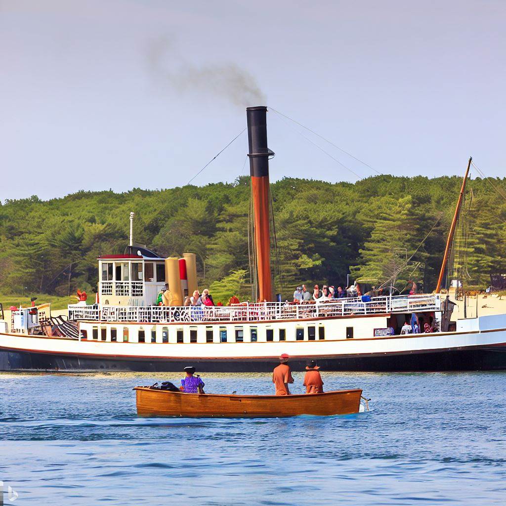
    If the journey called to you it was possible to take a visit to either island of Martha’s Vineyard or Nantucket via the New Bedford, Martha’s Vineyard & Nantucket Steamboat Line. This was the predecessor of the Steamship Authority. Several trips were leading out of Woods Hole daily.


    Excitement was in the air on Cape Cod when in June 1923 the Cape Cod Baseball League was formed with William Lovell of Hyannis serving as its first president. Four teams, Falmouth, Hyannis, Osterville, and Chatham would play a total of twelve games each. Opening night was July 10th as Falmouth defeated Osterville 11-7. It was not to worry for Osterville however as they would become the inaugural Cape League champions.
    As it is in present-day the crown jewel of Cape Cod summer in 1923 was the Barnstable County Fair. It opened Tuesday, August 28th, and was held for three days rather than a week like today. The fair was known as the Cattle Show and Fair of the Barnstable County Agricultural Society. It was held in Barnstable at the time near the County Court House. There were horse shows that drew upwards of 15,000 people. Also on the grounds were cattle shows, electrical appliance exhibits, swings, a merry-go-round, floral arrangements, and more.


    If unable to come to the Cape for the fair the next best thing was the annual Fourth of July festivities. There were town-sponsored fireworks displays. However, if you wanted to create your own show you could find ads in the local newspapers for stores like B.T. Gorham’s in Yarmouth Port, and A.C. Ryder’s in South Yarmouth selling all of the fireworks you could need. There were numerous special events including dinners, dancing, and more to celebrate Independence Day on Cape Cod.
    Before you know it time is up. Your vacation on Cape Cod during the summer of 1923 is now over. Hopefully, you enjoyed your time on the Cape’s shores. Before crossing back over the Canal be sure to gas up your vehicle. Also, stop by T.T. Hallet’s in Yarmouth Port to take with you some classic Cape Cod cranberries or other gifts and novelties to remind you of your trip. We hope it was the cat’s meow!

All Images created with the help of Bing AI

-------------------------------------------------------


Purchase a DVD copy of the Lady of the Dunes documentary here:

Purchase the new book Searching for the Lady of the Dunes written by 12th Generation Cape Codder Christopher Setterlund.

Saturday, July 23, 2022

In Their Footsteps: Cape Cod History - The First Cape Cod Canals


In 1914 the Cape Cod Canal opened and changed maritime travel in New England and beyond forever. The man-made waterway that connected Buzzards Bay to Cape Cod Bay had its construction begun June 1909. It was created by joining the Scusset River and the Manomet River. For over a century the Cape Cod Canal has been a well-traveled waterway. However did you know that the Cape Cod Canal was not the first attempt at created a cut-through around the Cape? What follows is the story of two other canal attempts in the decades before the current Cape Cod Canal was constructed.

The first attempted man-made cut through Cape Cod came two centuries ago much further east than the current canal location. ‘Jeremiah’s Gutter’ was the name of this waterway. ‘Gutter’ is another word for a channel or waterway. The name ‘Jeremiah’ comes from Jeremiah Smith who came from a founding Eastham family of the late 17th century.

On April 26, 1717 a strong nor’easter battered Cape Cod. It was in this storm that the famed pirate ship Whydah sank with all of its treasure aboard. This storm also carved a channel of varying depths running roughly from Town Cove in Orleans west to what is today Boat Meadow Beach in Eastham. The channel was used by British vessels trying to recover the sunken Whydah treasure in 1717. Afterwards it began to close up due both to nature and locals filling it in manually. The marshlands surrounding the channel, which stretched across the Cape from bayside in Eastham to oceanside in Orleans, often flooded causing the channel to be resurrected in a shallow form over the next several decades.

In 1804 it was decided to widen and deepen the passageway out along the previously created channel which ran over a mile and a half, nearly congruent with the Eastham/Orleans town line. The canal was named Jeremiah’s Gutter to honor Jeremiah Smith as it was much of his property that the waterway ran across.

Despite Jeremiah’s Gutter being widened and deepened it was barely used for nearly a decade. This changed during the War of 1812. It was during the second war with the British that the canal was used as a passageway by American ships carrying salt to avoid England’s blockade of Provincetown. This was the Gutter’s largest claim to fame.

c. Google Maps


Due to the large system of sandy tidal flats along Cape Cod Bay stretching from Brewster to Eastham the bay-side entrance to the canal often became choked with silt making that entrance way unreliable at low tide. It again was sparsely used by traveling vessels and would not be maintained. Jeremiah’s Gutter fell into disrepair and ceased to be used as a passageway for boats, although as late as 1844 large enough storms and tides would push water through making the canal whole again for a brief time.

Though it had begun fading into history the canal would have one more brush with fame when author Henry David Thoreau would mention Jeremiah’s Gutter in his iconic 1865 book Cape Cod. After that the eyes of the Cape would begin searching for a different location to create a more dependable canal. The idea of a new canal became more pressing during the late 1880’s when shipwrecks along Cape Cod’s coast occurred once every two weeks.

This is where the second canal comes into play. Jeremiah’s Gutter was a somewhat functioning canal. The new canal idea migrated west to Bass River. This was another natural waterway stretching from Nantucket Sound, up Bass River, and into Follins Pond.

Though ideas for another canal on Cape Cod had been bandied about for decades the proposed Bass River Canal first came to light in early 1887. It was the brainchild of longtime local shipping merchant Thomas Bacon. He had several good reasons why a man-made waterway would work at Bass River. First off it would save lives as the rough waves and shoals along the Atlantic Ocean side of Cape Cod had proven to be extremely dangerous for ships for centuries. In addition to being roughly ¾ finished already thanks to nature Bacon determined there would only be roughly two miles of excavation necessary between Follins Pond and Cape Cod Bay.

The original Bass River Bridge in the mid-1800's.(Historical Society of Old Yarmouth)


The natural waters were an average of ten-feet in depth. Bacon desired that the proposed canal be closer to sixteen-feet on average. The assumption was that the canal would empty into Cape Cod Bay through the flats between Bass Hole and Chapin Beach. Bass River was about 175-feet wide at its narrowest with its gravelly shores leaving little work to be done. Bacon’s plan was received well by those in the shipping industry. He enlisted the help of the newfound Cape Cod Ship Canal Co. to work with him on getting the project financed and underway.

Early estimates by Bacon had approximately two years of work needed to fully construct the Bass River Canal. He told a Boston Herald reporter in March 1887 that such a project would cost somewhere around $2.5 million($78 million in 2022). Throughout the spring of 1887 support grew for the canal with opposition being surprisingly low. Things progressed so well in fact that by November 1887 engineer Charles Thompson was surveying the proposed canal route.

Shockingly despite there seeming to be little reason why not to construct the Bass River Canal it was unanimously voted down by the committee on harbors and public lands in April 1888. Bacon was undeterred and the project was once against submitted to State Legislature in October 1888. His petition was ultimately withdrawn in January 1889.

It appeared as though the growing interest in building a canal between Bourne and Sandwich was making Bacon’s Bass River location less appealing. In addition Thomas Bacon had grown impatient with the efforts, or lack thereof, of the Cape Cod Ship Canal Co. to get the Bass River Canal project moving. In December 1890 Bacon petitioned to have the company removed from the project so that he could move on and find a more suitable finance partner. He then created the Bass River Canal Co.

In the court of public opinion it was a battle between the Bass River route and the Bourne-Sandwich route. The locals wanted a canal and were less interested in the bureaucratic battles behind the scenes between Bacon and the Cape Cod Ship Canal Co.

Thomas Bacon and his backers continued to petition the committee of harbors and public lands in 1891. There were conditions on the route’s width and depth, with provisions that a certain amount of capital($1 million) needing to be raised first before construction could begin. Several meetings were held with locals giving their two cents of the pros and cons of the canal.

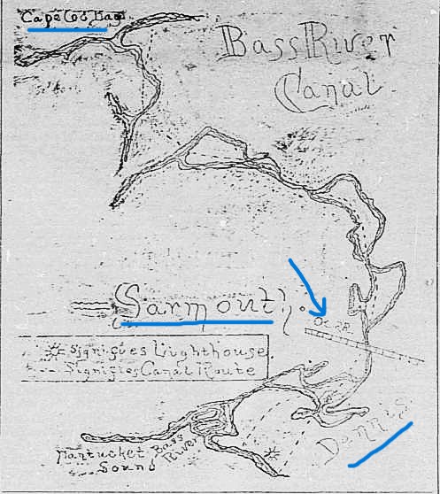
As momentum grew for a canal connecting Buzzards Bay to Cape Cod Bay Thomas Bacon’s Bass River project was continuously pushed down the road. Meetings and petitions were delayed and postponed repeatedly. In December 1891 things seemed to gain traction when civil engineer A.H. Knowles completed a thorough survey of the proposed route including a hand-drawn map.

The 1891 Bass River Canal map. The arrow points to where the Bass River Bridge was.


The Bourne-Sandwich canal was still seen as less feasible which gave the Bass River Canal hope in 1893 when it was yet again submitted as a petition. In June 1894 the Massachusetts House voted in favor of the Bass River Canal, and a year later the company secured a charter. Plans were in place to begin construction which was estimated to last two years and cost between $5-8 million ($176-282 million).

Sadly this is where the project died a death. After four years the charter had been dissolved and no work was ever done on the proposed Bass River Canal. In 1899 the charter for building a canal was granted to the Boston, New York, and Cape Cod Co. which intended to build the canal between Bourne and Sandwich.

For several years after the Bass River Canal Co. attempted to regain their own charter for their canal. Finally in May 1904 the Massachusetts State Senate dealt the company its death blow by flat out rejecting the Bass River Canal proposal. The doorway was open and in 1904 August Belmont purchased and reorganized the Boston, New York, and Cape Cod Co.

Sunset at the Cape Cod Canal.


The rest is history. Work began on the Cape Cod Canal as we know it on June 19, 1909, opening on July 29, 1914. The Bass River Canal idea, much like Jeremiah’s Gutter before it, faded into history. Or did it?

In 1966 rumblings began of a potential look into the feasibility of a Bass River canal. There was even a proposal in February 1966 for $15,000 for a study into whether such a project could be done. However, nothing came from it.

In the end Jeremiah’s Gutter actually was used by boats. The Bass River Canal spent decades locked in legislation before being dissolved without even a spoonful of dirt being shoveled. It is interesting though to think of what Cape Cod would look like today with a Bass River Canal and the Scusset and Manomet Rivers still intact in Bourne and Sandwich.
-------------------------------------------------------------------------

Tuesday, May 4, 2021

In Their Footsteps: Cape Cod History - How Mashnee Island Became A Village


    Off the coast of Bourne is a peninsula capped off by a fist-shaped land mass dotted with homes containing spectacular views. Along Mashnee Road it is a mile-long drive over a sandy causeway that leads you to this land mass. Surprisingly despite being connected rather apparently to the mainland this land mass at the end of the causeway is referred to as Mashnee Island. How can this be? Simple, because for the majority of its existence Mashnee was in fact an island. Here is the story of just how Mashnee Island lost its island status.

The causeway leading to Mashnee on the far left.


    Mashnee Island had been a 50-acre island populated by the Wampanoag Native Americans in Cape Cod's formative years. Richard Bourne, of whom the town is named, befriended the Natives on the island in the 17th century. They then allowed the Plymouth Colony the right to graze sheep, and protect them from a large local wolf population, on Mashnee. Farmers eventually gave up due to an infestation of disease carrying ticks during the early 18th century.

    It was home eventually to a large salt works beginning around the turn of the 19th century however a hurricane in 1835 destroyed it. In the latter half of the 19th century the island became a haven for summer parties, clambakes, and picnics by townspeople looking for an escape from the mainland. It even began to attract people from outside of New England. In 1870 a New York-based yacht club purchased the island with the intention of building a summer home there.

    The idea of a canal through Cape Cod had first been broached by Myles Standish in the 17th century. Even as early as the mid-19th century there were serious talks about a canal cutting through the Cape near Sandwich and Bourne. Back then there were even discussions of having it be built with convict labor. It took another several decades but the Cape Cod Canal would eventually become a reality.

    As the 20th century dawned the canal became a foregone conclusion. The only stumbling block was finding the financial capital to pay for such a monumental project. The massive Cape Cod Canal project was financed by August Belmont Jr. and his Boston, New York, and Cape Cod Canal Company. Belmont was a wealthy financier, heading up his late-father's August Belmont & Co. banking house. He had already financed the New York city subway and with ancestral connections to Cape Cod he felt inspired to back the creation of the Cape Cod Canal.

Dredge work being done on the Cape Cod Canal.(Historic Society of Old Yarmouth)


    With both the money and workers secured the first shovelful of dirt occurred June 22, 1909 when Belmont scooped a little dirt into a tin can using a Tiffany shovel. The waters of Buzzards Bay and Cape Cod Bay finally came together when the final shovelful of dirt was taken out July 4, 1914. Upon its debut the new canal stretched nearly eight miles in length, one hundred feet in width, and fifteen feet deep. The Rose Standish was the first ship through on July 29, 1914 with the canal officially opened to limited traffic on July 30th. There would though still be some construction going on into 1916. Belmont maintained ownership of the canal until his death in 1924. Ironically he died the day before the U.S. Senate recommended that the government purchase the canal.

    After the completion of the canal Mashnee Island saw more vessel traffic around it. In 1923 the entire island was purchased by Michael Murray of Newtonville. He created Camp Keewaydin, a sailing camp for boys ages 6-16. There were 22 buildings and the camp would be attended by 60-100 boys each summer.

    In the 1930's the Cape Cod Canal got some much-needed restructuring thanks to $26 million ($529.75 million in 2021) from President Franklin Roosevelt's 'New Deal.' Beginning in September 1933 the waterway was eventually increased in size to 540 feet wide and 32-feet deep. With this added size came an issue, that of the dredge spoils. Four million cubic yards of material was scooped from the canal and needed some place to go. Before the widening was even finished it was decided where they would end up. The dredge spoils would form a man-made dike connecting Mashnee Island and nearby Hog Island to the mainland.

A postcard shortly after the dike was finished.(Boston Public Library)


    In June 1936 work began on the dike. Part of the project including shaving away part of Hog Island. It only took roughly eight months for the dike to be finished and in February 1937 Mashnee Island was an island in name only. This also rerouted the traffic from the Cape Cod Canal to the outer side of Mashnee. At the outset of World War II in 1941 Camp Keewaydin was closed to make room for military personnel to be stationed there. Once the war ended Mashnee itself was changed.

    In 1947 Stephen Days partnered with island owner Michael Murray. Days built a series of cottages on half of the island available for summer rental. He also has a large recreation complex built complete with a small piano bar and a saltwater pool. This new concept was known as Mashnee Village. Until 1990 Mashnee was both a residential community and summer resort.

    Today Mashnee is mainly a private, tight-knit, community of around 30 families. There are only homes out there. The final public building, The Quahog Republic bar and restaurant, left Mashnee in October 2009, relocating to Falmouth. Those who inhabit the 100-plus homes don't mind though. They are blessed with spectacular panoramic views of Bourne, Wareham, and much of Buzzards Bay.

The view from Mashnee looking toward Bourne.


    Those old enough to remember the days when Mashnee was an island are few and far between now. For generations it has been seen as only a mile-long causeway from Bourne. Though now a quiet throwback to old Cape Cod neighborhoods Mashnee has a history as long and rich as the Cape itself. From the Wampanoag Tribe, to sheep grazing, from saltworks and sailing clubs, from the Cape Cod Canal to World War II and beyond, Mashnee has been through it all and yet still remains relatively off the map and off the beaten path.

--------------------------------------------------------------------------


Wednesday, April 29, 2020

Cape Cod's Most Beautiful Routes to Explore


2020 is currently perhaps the craziest time any of us will see in our lifetimes.  Quarantine is the norm and social distancing highly recommended.  However it is also recommended that people get outside somehow and get a daily dose of Vitamin D.  Those of us lucky enough to live on Cape Cod are close to endless possibilities to see beautiful sites in the sun.
This article will help you stay active and see the sites of one of the most unique places on earth while also keeping with the current new normal of the world during the pandemic.  You can choose to run, walk, bicycle, there is no right or wrong as long as you are moving. These are in no particular order but they all give you a glimpse into the heart and soul of Cape Cod.


Cape Cod Canal: This is an easy, paved bike trail which runs along the Canal and underneath two of the three bridges. Parking is free at the Railroad Bridge. The entirety of the bike path is between seven and eight miles. It is roughly five miles to make it from the railroad bridge to the Sagamore Bridge, ten miles round trip.
Looking toward the railroad bridge along the Cape Cod Canal.

Chatham Shore: For the active Cape Codder the shore route is a way to see many highlights of the quaint fishing village of Chatham. Parking is free on Cow Yard Lane which faces the North Beach Island cottages. The route takes you along Shore Rd. and past the legendary Chatham Bars Inn and Hydrangea House. Along the way you pass Chatham Lighthouse and head out to Morris Island. The route is between six and seven miles round trip.
Chatham Lighthouse

Province Lands Bike Trail: Nestled in the dunes of Provincetown this is an authentic look at untouched Cape Cod beauty. The bike trail follows the dunes rather than cutting through them. The loop from Herring Cove Beach, past Race Point Beach and back is filled with an almost infinite number of breathtaking sites. The route is anywhere from 5 ½ to 7 miles depending on how far you want to go.
A view of the ocean from the Province Lands Bike Trail

Osterville: Keeping with coastal scenery this route brings you from one of the most popular Cape beaches, Craigville, into rural Osterville. It begins at Craigville Beach and carries you away from the ocean to South Main Street.  Near Bumps River, you turn onto Starboard Lane with its numerous beautiful homes and secluded feel and follow to where it meets Old Mill Rd. This route is 6 miles round trip.

Yarmouth Beaches: Beautiful homes along the water? Check. Historic sites? Check. Several scenic beaches? Check. All that’s left is to take to the road to enjoy them all. Pleasant Street is where the route begins; you pass by beautiful homes along a shady portion of River Street before passing by the historic Judah Baker Windmill. After this you are just seconds from the ocean meaning anytime along the route you can cool off in the saltwater. Once you see Red Jacket Resort it’s time to turn and go back. This route is 6 miles.
The jetty at Smuggler's Beach

Cape Cod Rail Trail: Stretching from Dennis all the way into Wellfleet, with an offshoot into Chatham, the Rail Trail is nearly 30 miles of paved, scenic majesty. It is a bit much to do all of those miles but there is a great section that gives one a good idea of what the trail is all about. Starting at Headwaters Drive off of Rt. 124 in Harwich you head east across a cranberry bog, past several ponds and to the entrance of Nickerson State Park. This route is 12 miles round trip.
Sunset at Seymour Pond in Harwich

Nickerson State Park: Loaded with kettle ponds and campsites Nickerson is a virtual haven for active Cape Codders. The bike trail weaves along the main park roads but also has many offshoot trails that lead you into some of the park’s nooks and crannies. The main attractions of Nickerson are never more than a quick ride or run from the trail. The bike trail is 8 miles total.
Big Cliff Pond at Nickerson

Falmouth & Woods Hole: One of the science community's most well known spots coupled with sweeping panoramic views of Martha’s Vineyard make this a worthwhile jaunt. The Shining Sea Bikeway intersects at a few places but the route leads from Surf Drive Beach along the shore past Nobska Lighthouse and down to Water Street in Woods Hole. This route is 9 miles round trip.
Nobska Lighthouse

Coast To Coast: Going from coast to coast on the Cape can be long, like from Sandwich south to Mashpee, or short like near Pilgrim Lake in Truro. Going from Cape Cod Bay to the Atlantic Ocean in Wellfleet is close but just far enough to make it worthwhile. Parking at Mayo Beach is best. The route takes you on Long Pond Road over Rt. 6 and down to The Beachcomber on Cahoon Hollow Beach, then head back. This route is 7 miles round trip.
Mayo Beach

The Least Known Island: In Mashpee there is Monomoscoy Island tucked away from the ocean along Waquoit Bay. South Cape Beach State Park is a perfect starting point for this trip. Head away from the water and down Red Brook Road and down across a causeway. The island is a mix of old cottages and newer lush homes. This finger of land has tremendous water views on either side as you get toward the tip. It is a hidden gem that is better appreciated outside of a car. This route is 11 miles round trip.
The entrance to Monomoscoy

---------------------------------------------------------------
My 5th book, Cape Cod Nights, is on sale at Amazon.com and through Arcadia Publishing


View my previous blog posts: In Their Footsteps: Cape Cod History - Deacon John Doane


Photo Prints available here: Smug Mug.com

Be sure to check out my website: Christopher Setterlund.com